Beuningen
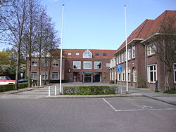
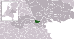
Beuningen (![]() pronunciation (info • help)) is a municipality and a town in the eastern Netherlands. It is near the city of Nijmegen. The river Waal is 1.5 kilometres (1 mi) to the north. The other towns in the municipality are: Ewijk, Weurt, and Winssen.
pronunciation (info • help)) is a municipality and a town in the eastern Netherlands. It is near the city of Nijmegen. The river Waal is 1.5 kilometres (1 mi) to the north. The other towns in the municipality are: Ewijk, Weurt, and Winssen.
 | |
 Location in Gelderland | |
| Coordinates: 51°52′N 5°47′E / 51.867°N 5.783°ECoordinates: 51°52′N 5°47′E / 51.867°N 5.783°E | |
| Country | Netherlands |
| Province | Gelderland |
| Government | |
| • Body | Municipal council |
| Area | |
| • Total | data missing km2 (Formatting error: invalid input when rounding sq mi) |
| • Land | data missing km2 (Formatting error: invalid input when rounding sq mi) |
| • Water | Expression error: Unrecognized word "data".Expression error: Unrecognized word "data".Expression error: Unrecognized word "data".Expression error: Unrecognized word "data".Expression error: Unrecognized word "data".Expression error: Unrecognized word "data".Expression error: Unrecognized word "data".Expression error: Unrecognized word "data".Expression error: Unrecognized word "data".Expression error: Unrecognized word "data".Expression error: Unrecognized word "data".Expression error: Unrecognized word "data".Expression error: Unrecognized word "data". km2 (Formatting error: invalid input when rounding sq mi) |
| Elevation | 9 m (30 ft) |
| Population (August 2017) | |
| • Total | data missing |
| Time zone | UTC+1 (CET) |
| • Summer (DST) | UTC+2 (CEST) |
| Postcode | 6550–6551, 6640–6645 |
| Website | www |
There is a restored windmill in the town, De Haag.
Beuningen Media
Topografische gemeentekaart. Resolutie: 400 pixels/km.*Kaartbeeld samengesteld uit de open geodata van de Top10NL en Top25namen (Kadaster), Creative Commons-BY licentie. Gebouwvlakken uit open geodata BAG extract. Wegen uit de OpenStreetMap, OpenStreetMap community. Reliëfschaduw uit de Actuele Hoogtekaart AHN2. Samenstelling en kleurenschema:


