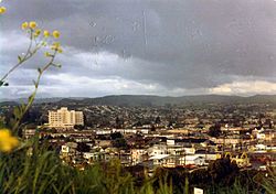
Castro Valley, California
Castro Valley is a census-designated place (CDP) in Alameda County, California, United States. As of the 2010 census, it is the fifth most populous unincorporated area in California and the twenty-third most populous in the United States. The population was 61,388 at the 2010 census.
 | |
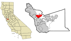
 Location of Castro Valley within Alameda County, California. | |
| Coordinates: 37°41′39″N 122°05′11″W / 37.69417°N 122.08639°WCoordinates: 37°41′39″N 122°05′11″W / 37.69417°N 122.08639°W[1] | |
| Country | |
| State | |
| County | Alameda |
| Government | |
| • State Senate | Bob Wieckowski (D)[2] |
| • State Assembly | Bill Quirk (D)[3] |
| • U. S. Congress | Eric Swalwell (D)[4] |
| Area | |
| • Total | 16.919 sq mi (43.82 km2) |
| • Land | 16.635 sq mi (43.08 km2) |
| • Water | 0.284 sq mi (0.74 km2) 1.68% |
| Elevation | 161 ft (49 m) |
| Population (2010) | |
| • Total | 61,388 |
| • Density | 3,628.35/sq mi (1,400.91/km2) |
| Time zone | UTC-8 (PST) |
| • Summer (DST) | UTC-7 (PDT) |
| ZIP codes | 94546, 94552 |
| FIPS code | 06-11964 |
| GNIS feature IDs | 1658237, 2407987 |
References
- ↑ "US Gazetteer files: 2010, 2000, and 1990". United States Census Bureau. 12 February 2011. Retrieved 23 April 2011.
- ↑ "Senators". State of California. Retrieved 18 March 2013.
- ↑ "Members Assembly". State of California. Retrieved 18 March 2013.
- ↑ "California's 15th Congressional District - Representatives & District Map". Civic Impulse, LLC. Retrieved 14 March 2013.
- ↑ "U.S. Census". Archived from the original on 2 July 2012. Retrieved 15 September 2012.
- ↑ "Castro Valley". Geographic Names Information System. United States Geological Survey.