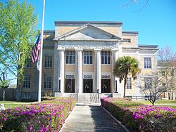
DeFuniak Springs, Florida
DeFuniak Springs is a city of Florida in the United States.
 | |
|
| |
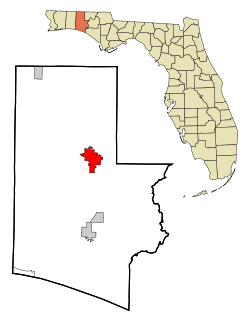
 Location in Walton County and the state of Florida | |
| Coordinates: 30°43′N 86°7′W / 30.717°N 86.117°WCoordinates: 30°43′N 86°7′W / 30.717°N 86.117°W | |
| Country | United States |
| State | Florida |
| County | Walton |
| Area | |
| • Total | 14.30 sq mi (37.03 km2) |
| • Land | 13.95 sq mi (36.13 km2) |
| • Water | 0.35 sq mi (0.90 km2) |
| Elevation | 259 ft (79 m) |
| Population | |
| • Total | 5,919 |
| • Density | 424.30/sq mi (163.82/km2) |
| Time zone | UTC-6 (Central (CST)) |
| • Summer (DST) | UTC-5 (CDT) |
| ZIP codes | 32433, 32435 |
| FIPS code | 12-16800[3] |
| GNIS feature ID | 0294592[4] |
| Website | http://www.defuniaksprings.net |
DeFuniak Springs, Florida Media
The former Louisville and Nashville Railroad depot, now the Walton County Heritage Museum
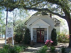
Walton-DeFuniak Library, the oldest extant library in Florida
Sun Bright, home of Sidney Johnston Catts, Florida's 22nd governor
References
- ↑ "2020 U.S. Gazetteer Files". United States Census Bureau. Retrieved October 31, 2021.
- ↑ "QuickFacts: DeFuniak Springs city, Florida". United States Census Bureau. Retrieved September 14, 2023.
- ↑ "U.S. Census website". United States Census Bureau. Retrieved 2008-01-31.
- ↑ "US Board on Geographic Names". United States Geological Survey. 2007-10-25. Retrieved 2008-01-31.


