File:1856 Japanese Edo Period Woodblock Map of Musashi Kuni (Tokyo or Edo Province) - Geographicus - MusashiKuni-japanese-1856.jpg

Original file (6,000 × 5,143 pixels, file size: 8.51 MB, MIME type: image/jpeg)
| This is a file from the Wikimedia Commons. The description on its description page there is shown below.
|
_-_Geographicus_-_MusashiKuni-japanese-1856.jpg)
| Musashinokuni.(ja:武蔵国) | ||||||
|---|---|---|---|---|---|---|
| Artist | ||||||
| Title |
Musashinokuni.(ja:武蔵国) |
|||||
| Description |
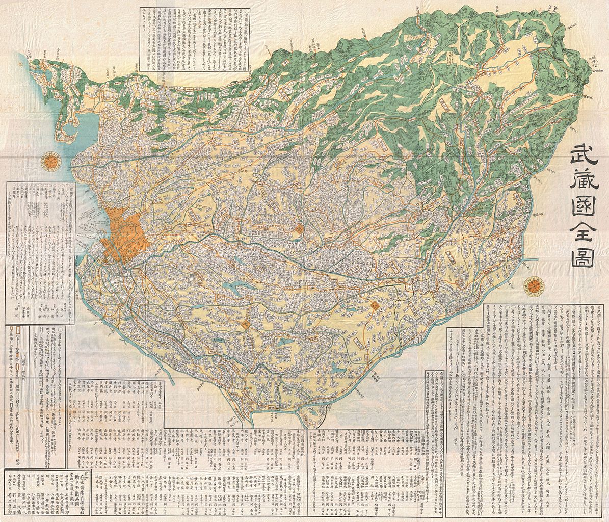
English: A large-format Edo Period Japanese woodblock map of Musashi Province dating to 1858. Musashi (武蔵国, Musashi no kuni) was a province of Japan, which today comprises Tokyo Prefecture, most of Saitama Prefecture and part of Kanagawa Prefecture, mainly Kawasaki and Yokohama. Musashi bordered on Kai, Kozuke, Sagami, Shimosa, and Shimotsuke Provinces. Musashi was the largest province in the Kanto region. It had its ancient capital in modern Fuchu, Tokyo and its provincial temple in what is now Kokubunji, Tokyo. By the Sengoku period, the main city was Edo, which became the dominant city of eastern Japan. Edo Castle was the headquarters of Tokugawa Ieyasu before the Battle of Sekigahara and became the dominant city of Japan during the Edo period, being renamed Tokyo during the Meiji Restoration. Printed in the traditional Japanese style popular during the Edo Period, with topograpy shown in profile, no firm directional orientation, and map titles in cartouches. |
|||||
| Date | 1856 (dated) | |||||
| Dimensions | height: 44 in (111.7 cm); width: 51 in (129.5 cm) | |||||
| Accession number |
Geographicus link: MusashiKuni-japanese-1856 |
|||||
| Source/Photographer |
|
|||||
| Permission (Reusing this file) |
|
|||||
File history
Click on a date/time to view the file as it appeared at that time.
| Date/Time | Dimensions | User | Comment | |
|---|---|---|---|---|
| current | 14:29, 24 March 2011 | 6,000 × 5,143 (8.51 MB) | BotMultichillT | {{subst:User:Multichill/Geographicus |link=http://www.geographicus.com/P/AntiqueMap/MusashiKuni-japanese-1856 |product_name=1856 Japanese Edo Period Woodblock Map of Musashi Kuni (Tokyo or Edo Province) |map_title=Musashi Kuni. |description=A breathtaking |
File usage
The following page uses this file:
_-_Geographicus_-_MusashiKuni-japanese-1856.jpg)