File:1912 China map from National Geographic.jpg

Size of this preview: 786 × 600 pixels. Other resolutions: 315 × 240 pixels | 629 × 480 pixels | 1,007 × 768 pixels | 1,280 × 977 pixels | 6,980 × 5,326 pixels.
Original file (6,980 × 5,326 pixels, file size: 10.65 MB, MIME type: image/jpeg)
| This is a file from the Wikimedia Commons. The description on its description page there is shown below.
|
Summary
| Description |
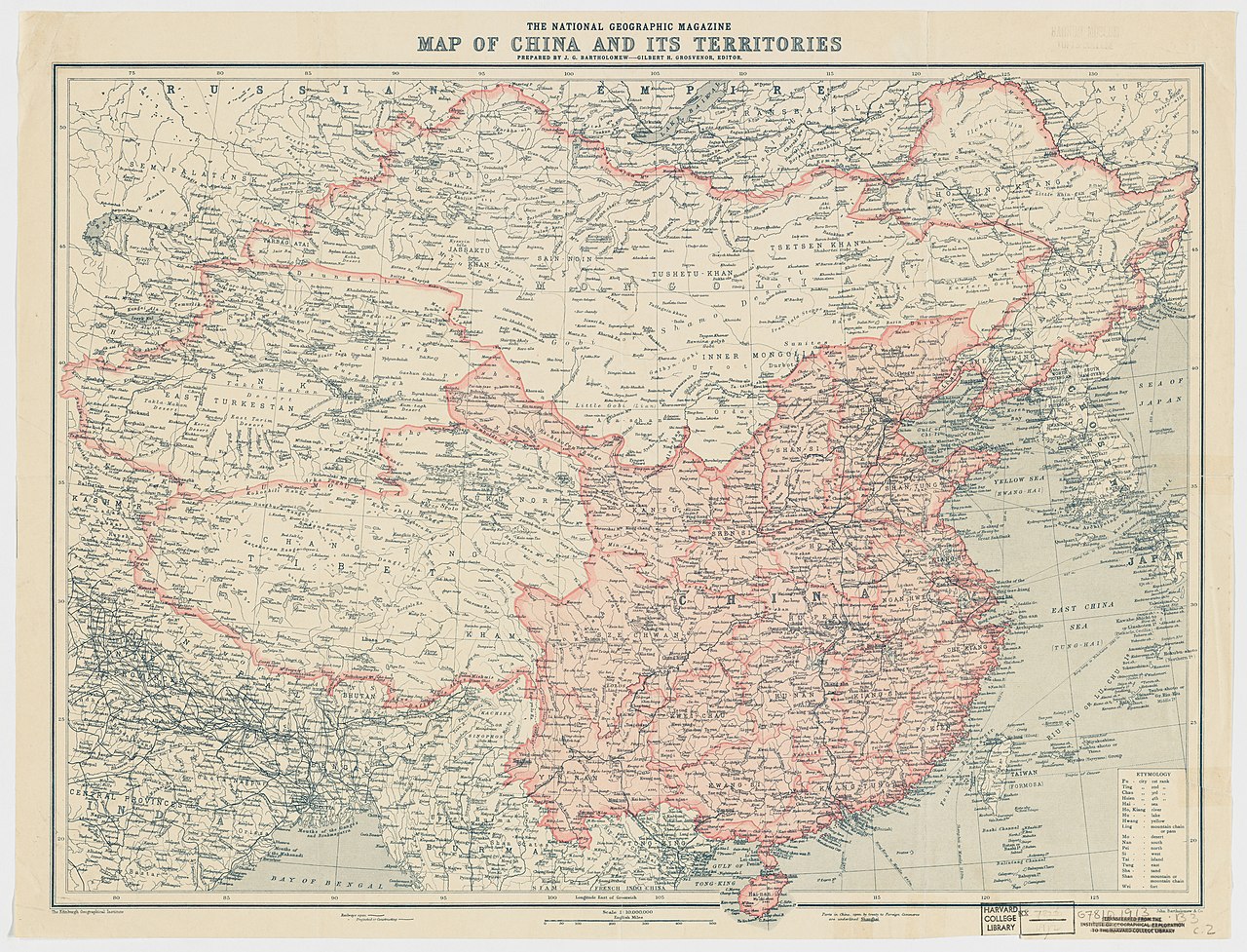
English: The National Geographic Magazine map of China and its territories. Commons editors have searched the map and found mentions of: Tibet, Beiyang Government, Amdo, Kham, Ü-Tsang, Tibet, Changtang, Qing Dynasty, Tibet, Kashmir, Bhutan, Nepal, Myanmar, Bengal, Mongolia, Tibet, India, Korea, Gansu, East Turkestan, Sikkim, Himalayas, Tibet, Mekong, Salween River, Yellow River, Yangtze River, Kunlun Mountains, Yamdrok Lake, Lake Baikal, Lake Balkhash, Qinghai Lake, Rima, Tibet
中文(中国大陆):中国地图,出自1912年10月美国《國家地理雜誌》 |
||||||||||||||||||||
| Date | |||||||||||||||||||||
| Source |
Harvard University Library 1912年10月國家地理雜誌 |
||||||||||||||||||||
| Creator |
Edinburgh Geographical Institute |
||||||||||||||||||||
| Permission (Reusing this file) |
|
||||||||||||||||||||
| Georeferencing | If inappropriate please set warp_status = skip to hide. | ||||||||||||||||||||
| Other versions | Digital Commonwealth | ||||||||||||||||||||

.jpg)
| Annotations | This image is annotated: View the annotations at Commons |
File history
Click on a date/time to view the file as it appeared at that time.
| Date/Time | Dimensions | User | Comment | |
|---|---|---|---|---|
| current | 15:50, 17 February 2015 | 6,980 × 5,326 (10.65 MB) | Scewing | Higher resolution |
File usage
The following page uses this file: