File:4U9525 flight path v1.svg

Size of this PNG preview of this SVG file: 440 × 366 pixels. Other resolutions: 289 × 240 pixels | 577 × 480 pixels | 721 × 600 pixels | 923 × 768 pixels | 1,231 × 1,024 pixels.
Original file (SVG file, nominally 440 × 366 pixels, file size: 187 KB)
| This is a file from the Wikimedia Commons. The description on its description page there is shown below.
|
Summary
File:4U9525 flight path v1.svg has 2 translations.

Catalan

English


| Description |
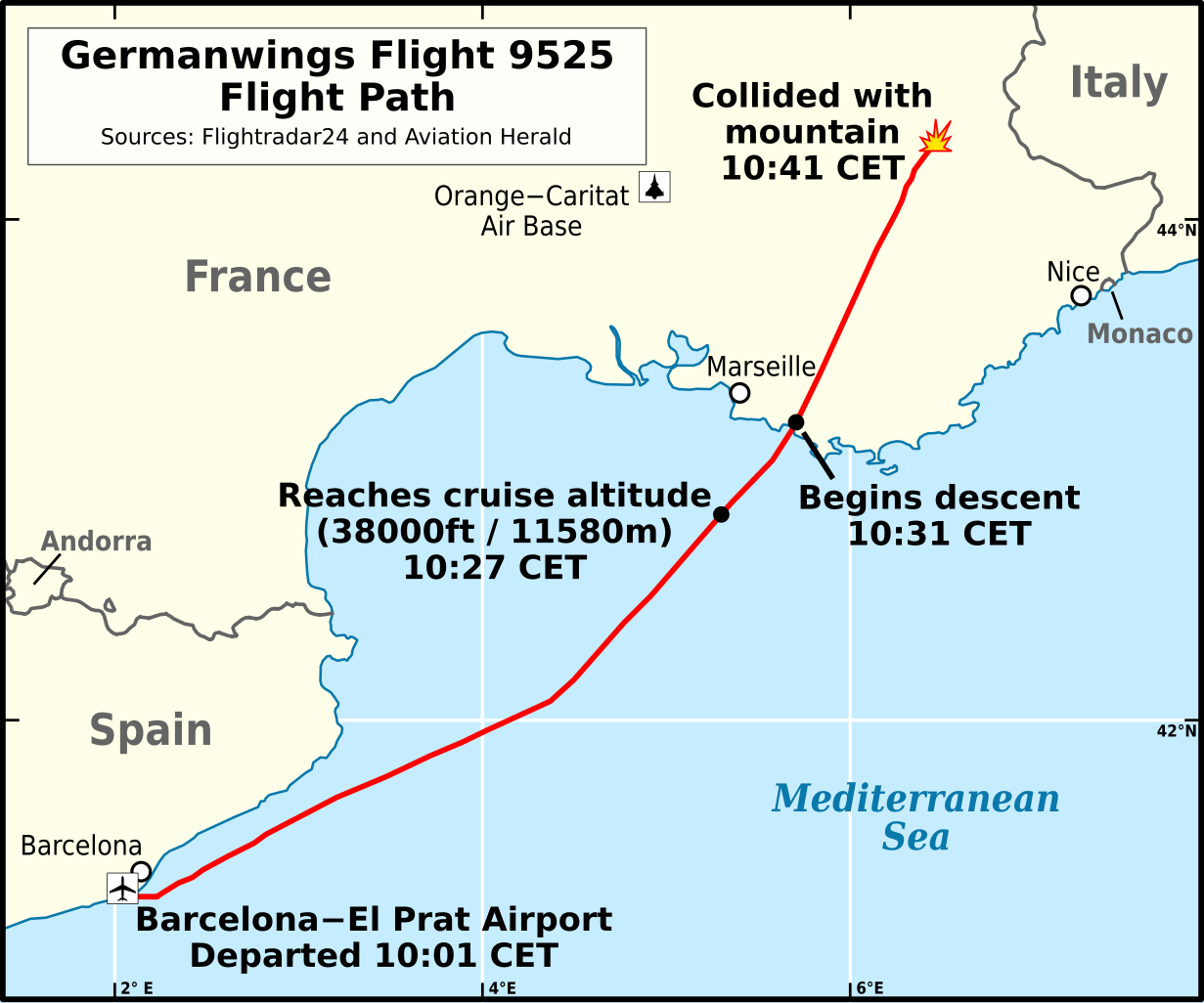
English: Flight path of Germanwings Flight 9525 (English).
Català: Trajectòria de vol Vol 9525 de Germanwings
Deutsch: Verlauf von Germanwings-Flug 9525 (Englisch).
Español: Trayectoria de Vuelo 9525 de Germanwings (Inglés).
Français : Trajectoire de vol Vol 9525 Germanwings (Anglais) |
|||
| Date | ||||
| Source |
Own work based on:
|
|||
| Author | Andrew Heneen | |||
| Permission (Reusing this file) |
I, the copyright holder of this work, hereby publish it under the following license: This file is licensed under the Creative Commons Attribution 4.0 International license.
|
|||
| Other versions | ||||
| SVG development |

File history
Click on a date/time to view the file as it appeared at that time.
| Date/Time | Dimensions | User | Comment | |
|---|---|---|---|---|
| current | 05:28, 20 September 2023 | 440 × 366 (187 KB) | Lalpino | File uploaded using svgtranslate tool (https://svgtranslate.toolforge.org/). Added translation for ca. |
File usage
The following 2 pages use this file: