File:Abies balsamea range map.svg

Size of this PNG preview of this SVG file: 576 × 599 pixels. Other resolutions: 231 × 240 pixels | 461 × 480 pixels | 576 × 600 pixels | 738 × 768 pixels | 984 × 1,024 pixels | 1,300 × 1,353 pixels.
Original file (SVG file, nominally 1,300 × 1,353 pixels, file size: 770 KB)
| This is a file from the Wikimedia Commons. The description on its description page there is shown below.
|
Summary
| Description |
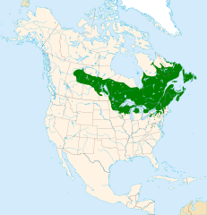
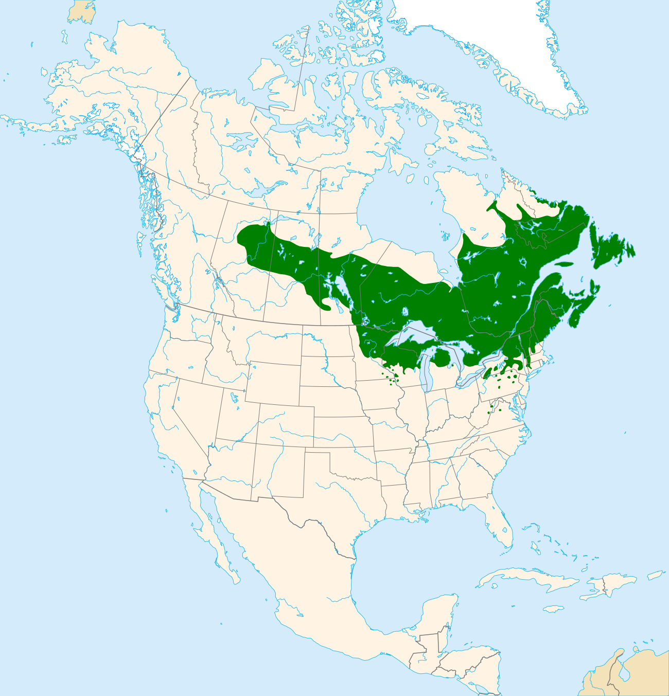
English: Range map of balsam fir (Abies balsamea).
Suomi: Palsamipihdan (Abies balsamea) levinneisyys. |
| Date | |
| Source | Own work |
| Author | Halava |
Data sources:
- Coastlines, lakes, rivers, glaciers and political borders are from Natural Earth.
- Distributional data is from U.S. Geological Survey.
Map projection: Lambert Azimuthal Equal Area Projection
Datum: North American Datum 1983
Licensing
I, the copyright holder of this work, hereby publish it under the following license:
This file is licensed under the Creative Commons Attribution-Share Alike 3.0 Unported license.
- You are free:
- to share – to copy, distribute and transmit the work
- to remix – to adapt the work
- Under the following conditions:
- attribution – You must give appropriate credit, provide a link to the license, and indicate if changes were made. You may do so in any reasonable manner, but not in any way that suggests the licensor endorses you or your use.
- share alike – If you remix, transform, or build upon the material, you must distribute your contributions under the same or compatible license as the original.
File history
Click on a date/time to view the file as it appeared at that time.
| Date/Time | Dimensions | User | Comment | |
|---|---|---|---|---|
| current | 12:14, 24 July 2012 | 1,300 × 1,353 (770 KB) | Halava | Thinner coastline |
File usage
The following page uses this file: