File:Antony map.svg

Size of this PNG preview of this SVG file: 587 × 600 pixels. Other resolutions: 235 × 240 pixels | 470 × 480 pixels | 752 × 768 pixels | 1,002 × 1,024 pixels | 1,552 × 1,586 pixels.
Original file (SVG file, nominally 1,552 × 1,586 pixels, file size: 540 KB)
| This is a file from the Wikimedia Commons. The description on its description page there is shown below.
|
Summary
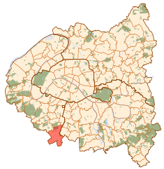
| Description | Map of Paris and its inner ring départements, localization of Antony (Author: Metropolitan). |
| Date | 10 October 2006 (original upload date) |
| Source | No machine-readable source provided. Own work assumed (based on copyright claims). |
| Author | No machine-readable author provided. Metropolitan~commonswiki assumed (based on copyright claims). |
Licensing
| I, the copyright holder of this work, release this work into the public domain. This applies worldwide. In some countries this may not be legally possible; if so: I grant anyone the right to use this work for any purpose, without any conditions, unless such conditions are required by law. |
File history
Click on a date/time to view the file as it appeared at that time.
| Date/Time | Dimensions | User | Comment | |
|---|---|---|---|---|
| current | 04:57, 10 October 2006 | 1,552 × 1,586 (540 KB) | Metropolitan~commonswiki | Map of Paris and its inner ring départements, localization of Antony (Author: Metropolitan). Category:Locator maps for municipalities of Hauts-de-Seine |
File usage
The following page uses this file: