File:AshfieldNSWsatellite.jpg
Size of this preview: 800 × 597 pixels. Other resolutions: 320 × 239 pixels | 640 × 477 pixels | 893 × 666 pixels.
Original file (893 × 666 pixels, file size: 335 KB, MIME type: image/jpeg)
| This is a file from the Wikimedia Commons. The description on its description page there is shown below.
|
Summary
| Description |
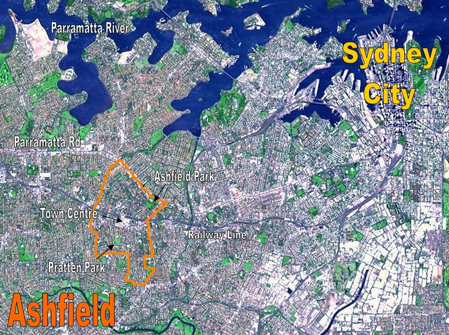
English: Location Map for the suburb of Ashfield, NSW based on NASA satellite map. Modified to identify suburb boundaries and identifiable landmarks. |
| Date | |
| Source | Based on http://photojournal.jpl.nasa.gov/catalog/PIA03498 |
| Author | NASA with adaptations by Crico at en.wikipedia, based on a NASA picture. |
Licensing
| This file is in the public domain in the United States because it was solely created by NASA. NASA copyright policy states that "NASA material is not protected by copyright unless noted". (See Template:PD-USGov, NASA copyright policy page or JPL Image Use Policy.) | ||
 |
Warnings:
|
Original upload log
The original description page was here. All following user names refer to en.wikipedia.
- 2007-03-23 04:10 Crico 893×666× (342878 bytes) Location Map for the suburb of Ashfield, NSW based on NASA satellite map. Modified to identify suburb boundaries and identifiable landmarks. Original NASA image number: [[:Image:PIA03498.jpg|PIA03498]] {{PD-USGov-NASA}}
File history
Click on a date/time to view the file as it appeared at that time.
| Date/Time | Dimensions | User | Comment | |
|---|---|---|---|---|
| current | 16:18, 28 February 2009 | 893 × 666 (335 KB) | File Upload Bot (Magnus Manske) | {{BotMoveToCommons|en.wikipedia|year={{subst:CURRENTYEAR}}|month={{subst:CURRENTMONTHNAME}}|day={{subst:CURRENTDAY}}}} {{Information |Description={{en|Location Map for the suburb of Ashfield, NSW based on NASA satellite map. Modified to identify suburb b |
File usage
The following page uses this file: