File:Atiumap.png

Size of this preview: 725 × 600 pixels. Other resolutions: 290 × 240 pixels | 580 × 480 pixels | 928 × 768 pixels | 1,237 × 1,024 pixels | 1,676 × 1,387 pixels.
Original file (1,676 × 1,387 pixels, file size: 393 KB, MIME type: image/png)
| This is a file from the Wikimedia Commons. The description on its description page there is shown below.
|
Summary
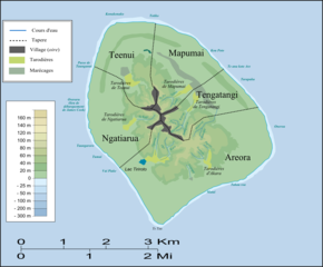
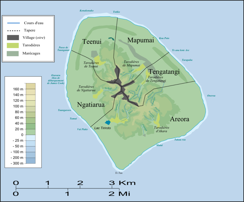
| Description | Carte d'Atiu (topographie et tapere)/Map of Atiu (topography and tapere) |
| Date | |
| Source | Own work |
| Author | Nevers |
Licensing
| I, the copyright holder of this work, release this work into the public domain. This applies worldwide. In some countries this may not be legally possible; if so: I grant anyone the right to use this work for any purpose, without any conditions, unless such conditions are required by law. |
File history
Click on a date/time to view the file as it appeared at that time.
| Date/Time | Dimensions | User | Comment | |
|---|---|---|---|---|
| current | 09:48, 3 January 2008 | 1,676 × 1,387 (393 KB) | Nevers | {{Information |Description=Carte d'Atiu (topographie et tapere)/Map of Atiu (topography and tapere) |Source=travail personnel |Date=Janvier 2008 |Author= Nevers |Permission= |other_versions= }} Category:Cook Islands |
File usage
The following 3 pages use this file: