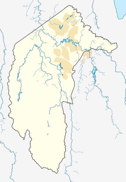
File:Australia Capital Territory location map.svg

Size of this PNG preview of this SVG file: 414 × 600 pixels. Other resolutions: 166 × 240 pixels | 331 × 480 pixels | 530 × 768 pixels | 707 × 1,024 pixels | 477 × 691 pixels.
Original file (SVG file, nominally 477 × 691 pixels, file size: 272 KB)
| This is a file from the Wikimedia Commons. The description on its description page there is shown below.
|
| Description |
Deutsch: Positionskarte des Australian Capital Territory, Australien.
Mercator-Projektion. Geographische Begrenzungen der Karte:
English: Location map of the Australian Capital Territory, Australia.
Mercator projection. Geographic limits of the map:
|
|||
| Date |
Original Version: 2012-12-19 |
|||
| Source | Own work, using OpenStreetMap data. Urban areas redrawn using OpenStreetMap data current at date above. | |||
| Author |
Original Version: Carport |
|||
| Permission (Reusing this file) |
This file is licensed under the Creative Commons Attribution-Share Alike 3.0 Unported license.
|
File history
Click on a date/time to view the file as it appeared at that time.
| Date/Time | Dimensions | User | Comment | |
|---|---|---|---|---|
| current | 02:39, 2 June 2013 | 477 × 691 (272 KB) | Nbound | Back to more neutral colours |
File usage
The following page uses this file: