File:Berry-au-Bac (Aisne) Église.JPG
Size of this preview: 450 × 600 pixels. Other resolutions: 180 × 240 pixels | 360 × 480 pixels | 576 × 768 pixels | 768 × 1,024 pixels | 2,736 × 3,648 pixels.
Original file (2,736 × 3,648 pixels, file size: 2.92 MB, MIME type: image/jpeg)
This is a file from the Wikimedia Commons. The description on its description page there is shown below.
|
Summary
DescriptionBerry-au-Bac (Aisne) Église.JPG |
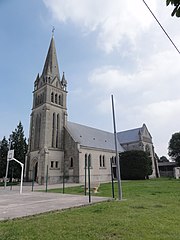
Français : Berry-au-Bac (Aisne) Église
|
||
Date | |||
Source | Own work | ||
Author | Havang(nl) |
Camera location | 49° 24′ 04.29″ N, 3° 54′ 00.48″ E | View this and other nearby images on: OpenStreetMap | 49.401191; 3.900133 |
---|
The geographical information in this file was retrospectively estimated.
The location may therefore be somewhat imprecise. Verifying and refining these coordinates is strongly encouraged. |
Licensing
I, the copyright holder of this work, hereby publish it under the following license:
This file is made available under the Creative Commons CC0 1.0 Universal Public Domain Dedication. | |
The person who associated a work with this deed has dedicated the work to the public domain by waiving all of their rights to the work worldwide under copyright law, including all related and neighboring rights, to the extent allowed by law. You can copy, modify, distribute and perform the work, even for commercial purposes, all without asking permission.
http://creativecommons.org/publicdomain/zero/1.0/deed.enCC0Creative Commons Zero, Public Domain Dedicationfalsefalse |
Items portrayed in this file
depicts
30 May 2012
49°24'4.288"N, 3°54'0.479"E
0.003125 second
4.25 millimetre
125
image/jpeg
b510d25f1cdb55362f44420ceda0151ef5f87449
3,058,371 byte
3,648 pixel
2,736 pixel
File history
Click on a date/time to view the file as it appeared at that time.
Date/Time | Dimensions | User | Comment | |
---|---|---|---|---|
current | 13:21, 10 July 2012 | 2,736 × 3,648 (2.92 MB) | Havang(nl) |
File usage
The following page uses this file:
Metadata
This file contains additional information, probably added from the digital camera or scanner used to create or digitize it.
If the file has been modified from its original state, some details may not fully reflect the modified file.
Camera manufacturer | SONY |
---|---|
Camera model | DSC-HX5V |
Exposure time | 1/320 sec (0.003125) |
F Number | f/8 |
ISO speed rating | 125 |
Date and time of data generation | 09:40, 30 May 2012 |
Lens focal length | 4.25 mm |
Latitude | 49° 24′ 4.29″ N |
Longitude | 3° 54′ 0.48″ E |
Altitude | 38.7 meters above sea level |
Orientation | Normal |
Horizontal resolution | 72 dpi |
Vertical resolution | 72 dpi |
Software used | Microsoft Windows Photo Viewer 6.1.7600.16385 |
File change date and time | 16:21, 5 July 2012 |
Y and C positioning | Co-sited |
Exposure Program | Normal program |
Exif version | 2.21 |
Date and time of digitizing | 09:40, 30 May 2012 |
Meaning of each component |
|
Image compression mode | 4 |
APEX exposure bias | 0 |
Maximum land aperture | 3.625 APEX (f/3.51) |
Metering mode | Pattern |
Light source | Unknown |
Flash | Flash did not fire, compulsory flash suppression |
Supported Flashpix version | 1 |
Color space | sRGB |
File source | Digital still camera |
Scene type | A directly photographed image |
Custom image processing | Normal process |
Exposure mode | Auto exposure |
White balance | Auto white balance |
Scene capture type | Standard |
Contrast | Normal |
Saturation | Normal |
Sharpness | Normal |
GPS time (atomic clock) | 08:37 |
Receiver status | Measurement interoperability |
Measurement mode | 3-dimensional measurement |
Speed unit | Kilometers per hour |
Speed of GPS receiver | 0.7 |
Reference for direction of movement | True direction |
Direction of movement | 301.14 |
Reference for direction of image | Magnetic direction |
Direction of image | 2 |
Geodetic survey data used | WGS-84 |
GPS date | 30 May 2012 |
GPS differential correction | 0 |
GPS tag version | 2.2.0.0 |