File:Borneo Locator Topography.png

Size of this preview: 553 × 599 pixels. Other resolutions: 221 × 240 pixels | 443 × 480 pixels | 554 × 600 pixels | 709 × 768 pixels | 945 × 1,024 pixels | 1,605 × 1,739 pixels.
Original file (1,605 × 1,739 pixels, file size: 2.61 MB, MIME type: image/png)
| This is a file from the Wikimedia Commons. The description on its description page there is shown below.
|
Summary
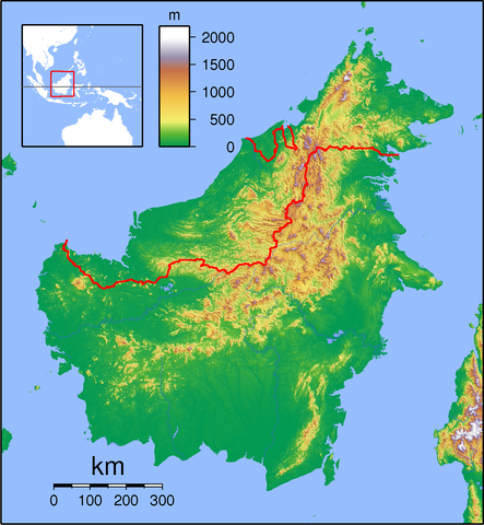
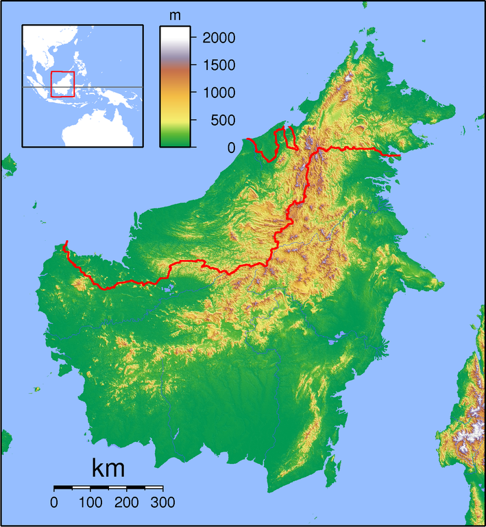
| Description | Topographic locator map of Borneo. Created with GMT from public domain SRTM data. For non-locator version, see Image:Borneo Topography.png. Left:108 Bottom:-5 Right:120 Top:8 |
| Date | |
| Source | Own work |
| Author | Sadalmelik |
Licensing
I, the copyright holder of this work, hereby publish it under the following licenses:

|
Permission is granted to copy, distribute and/or modify this document under the terms of the GNU Free Documentation License, Version 1.2 or any later version published by the Free Software Foundation; with no Invariant Sections, no Front-Cover Texts, and no Back-Cover Texts. A copy of the license is included in the section entitled GNU Free Documentation License. |
This file is licensed under the Creative Commons Attribution-Share Alike 3.0 Unported, 2.5 Generic, 2.0 Generic and 1.0 Generic license.
- You are free:
- to share – to copy, distribute and transmit the work
- to remix – to adapt the work
- Under the following conditions:
- attribution – You must give appropriate credit, provide a link to the license, and indicate if changes were made. You may do so in any reasonable manner, but not in any way that suggests the licensor endorses you or your use.
- share alike – If you remix, transform, or build upon the material, you must distribute your contributions under the same or compatible license as the original.
You may select the license of your choice.
File history
Click on a date/time to view the file as it appeared at that time.
| Date/Time | Dimensions | User | Comment | |
|---|---|---|---|---|
| current | 12:24, 1 September 2007 | 1,605 × 1,739 (2.61 MB) | Sadalmelik | {{Information |Description=Topographic locator map of Borneo. Created wth GMT from public domain SRTM data. For non-locator version, see Image:Borneo Topography.png. Left:108 Bottom:-5 Right:120 Top:8 |Source=self-made |Date=Sep 1, 2007 |Author= [[Us |
File usage
There are no pages that use this file.