File:Boston molasses detail map.png

Size of this preview: 706 × 599 pixels. Other resolutions: 283 × 240 pixels | 565 × 480 pixels | 707 × 600 pixels | 874 × 742 pixels.
Original file (874 × 742 pixels, file size: 176 KB, MIME type: image/png)
| This is a file from the Wikimedia Commons. The description on its description page there is shown below.
|
Summary
| Description |
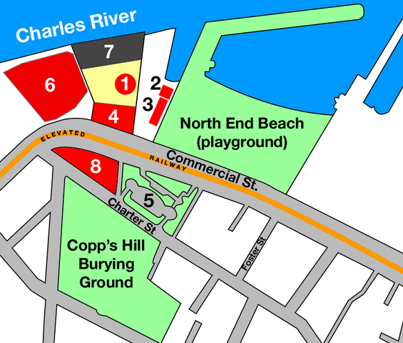
English: Map based on based on official City of Boston, Massachusetts maps published in 1895 and 1915, adding data from published accounts and deduced from photos of the Boston molasses disaster.
|
| Date | |
| Source | Own work |
| Author | User:IMeowbot |
Licensing
| I, the copyright holder of this work, release this work into the public domain. This applies worldwide. In some countries this may not be legally possible; if so: I grant anyone the right to use this work for any purpose, without any conditions, unless such conditions are required by law. |
File history
Click on a date/time to view the file as it appeared at that time.
| Date/Time | Dimensions | User | Comment | |
|---|---|---|---|---|
| current | 06:02, 21 March 2005 | 874 × 742 (176 KB) | IMeowbot~commonswiki | Official spelling has the apostrophe. |
File usage
The following page uses this file: