File:COVID-19 outbreak France per capita cases map.svg

Size of this PNG preview of this SVG file: 575 × 575 pixels. Other resolutions: 240 × 240 pixels | 480 × 480 pixels | 600 × 600 pixels | 768 × 768 pixels | 1,024 × 1,024 pixels.
Original file (SVG file, nominally 575 × 575 pixels, file size: 33 KB)
| This is a file from the Wikimedia Commons. The description on its description page there is shown below.
|
Summary
| Description |
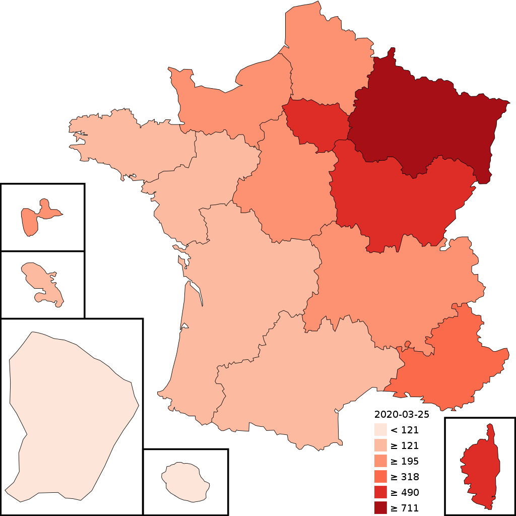
English: Confirmed cases of COVID-19 per million inhabitants in France by region[1] |
| Date | |
| Source |
Own work; created using Python script This vector image includes elements that have been taken or adapted from this file: |
| Author | Ythlev |
| SVG development | This map was created with an unknown SVG tool. |
Licensing
I, the copyright holder of this work, hereby publish it under the following license:
This file is licensed under the Creative Commons Attribution-Share Alike 4.0 International license.
- You are free:
- to share – to copy, distribute and transmit the work
- to remix – to adapt the work
- Under the following conditions:
- attribution – You must give appropriate credit, provide a link to the license, and indicate if changes were made. You may do so in any reasonable manner, but not in any way that suggests the licensor endorses you or your use.
- share alike – If you remix, transform, or build upon the material, you must distribute your contributions under the same or compatible license as the original.
File history
Click on a date/time to view the file as it appeared at that time.
| Date/Time | Dimensions | User | Comment | |
|---|---|---|---|---|
| current | 12:57, 11 April 2020 | 575 × 575 (33 KB) | JoKalliauer | font-family="DejaVu Sans" |
File usage
The following page uses this file: