File:CaliforniaTropicalCycloneBreakpoints.png
No higher resolution available.
CaliforniaTropicalCycloneBreakpoints.png (564 × 550 pixels, file size: 3 KB, MIME type: image/png)
| This is a file from the Wikimedia Commons. The description on its description page there is shown below.
|
Summary
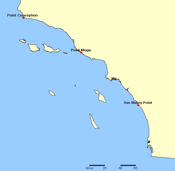
A map of breakpoints for w:tropical cyclones in California.
It is made using screenshots of online parts of the National Atlas of the United States. The screenshots are put together using MS Paint to make a map of breakpoints.
The screenshots were acquired from this site archive copy at the Wayback Machine, which is part of the National Atlas. The plotted locations were found by searching for them at the aforementioned site.
This map was obtained from an edition of the National Atlas of the United States. Like almost all works of the U.S. federal government, works from the National Atlas are in the public domain in the United States.
Online access: NationalAtlas.gov | 1970 print edition: Library of Congress, Perry-Castañeda Library
|
National Atlas Site archive copy at the Wayback Machine
--wikipedia:en:user:Miss Madeline
| Description |
English: Map of warning breakpoints.
Español: Mapa de los puntos de rompimiento de aviso.
Simple English: Map of warning stations. |
||||||
| Date | |||||||
| Source | w:Image:CaliforniaTropicalCycloneBreakpoints.JPG | ||||||
| Author | wikipedia:en:user:Miss Madeline (original uploader) | ||||||
| Permission (Reusing this file) |
|
||||||
| Other versions | w:Image:CaliforniaTropicalCycloneBreakpoints.JPG | ||||||

File history
Click on a date/time to view the file as it appeared at that time.
| Date/Time | Dimensions | User | Comment | |
|---|---|---|---|---|
| current | 15:40, 26 October 2006 | 564 × 550 (3 KB) | Helix84 | == Summary == A map of breakpoints for w:tropical cyclones in California. It is made using screenshots of online parts of the National Atlas of the United States. The screenshots are put together using MS Paint to make a map of breakpoints. The scre |
File usage
The following page uses this file: