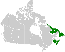
File:Canada Atlantic provinces map.png

Canada_Atlantic_provinces_map.png(262 × 212 pixels, file size: 4 KB, MIME type: image/png)

Commons-logo.svg This is a file from the Wikimedia Commons. The description on its description page there is shown below.
Commons is a freely licensed media file repository. You can help.

Summary

Description
English: Map of the Atlantic provinces. See Image:Canada provinces blank vide.png for additional information.
Français : Carte des provinces Atlantiques. Voir Image:Canada provinces blank vide.png pour de renseignements supplémentaires.
Date 24 September 2005 (original upload date)
Source No machine-readable source provided. Own work assumed (based on copyright claims).
Author No machine-readable author provided. QuartierLatin1968 assumed (based on copyright claims).

Licensing

Public domain I, the copyright holder of this work, release this work into the public domain. This applies worldwide.
In some countries this may not be legally possible; if so:
I grant anyone the right to use this work for any purpose, without any conditions, unless such conditions are required by law.

Captions

Add a one-line explanation of what this file represents

Items portrayed in this file

depicts

24 September 2005

image/png

f1e46d739e8125e807e12b31f52cdb92abc28d94

4,592 byte

212 pixel

262 pixel

File history

Click on a date/time to view the file as it appeared at that time.

Date/TimeDimensionsUserComment
current19:17, 23 September 2005262 × 212 (4 KB)QuartierLatin1968* {{english}} Map of the Atlantic provinces. See Image:Canada provinces blank vide.png for additional information. * {{français}} Carte des provinces Atlantiques. Voir Image:Canada provinces blank vide.png pour de renseignements supplémentaire

There are no pages that use this file.