File:Canada population per senator map.svg

Size of this PNG preview of this SVG file: 619 × 600 pixels. Other resolutions: 248 × 240 pixels | 496 × 480 pixels | 793 × 768 pixels | 1,057 × 1,024 pixels | 1,304 × 1,263 pixels.
Original file (SVG file, nominally 1,304 × 1,263 pixels, file size: 113 KB)
| This is a file from the Wikimedia Commons. The description on its description page there is shown below.
|
Summary
| Description |
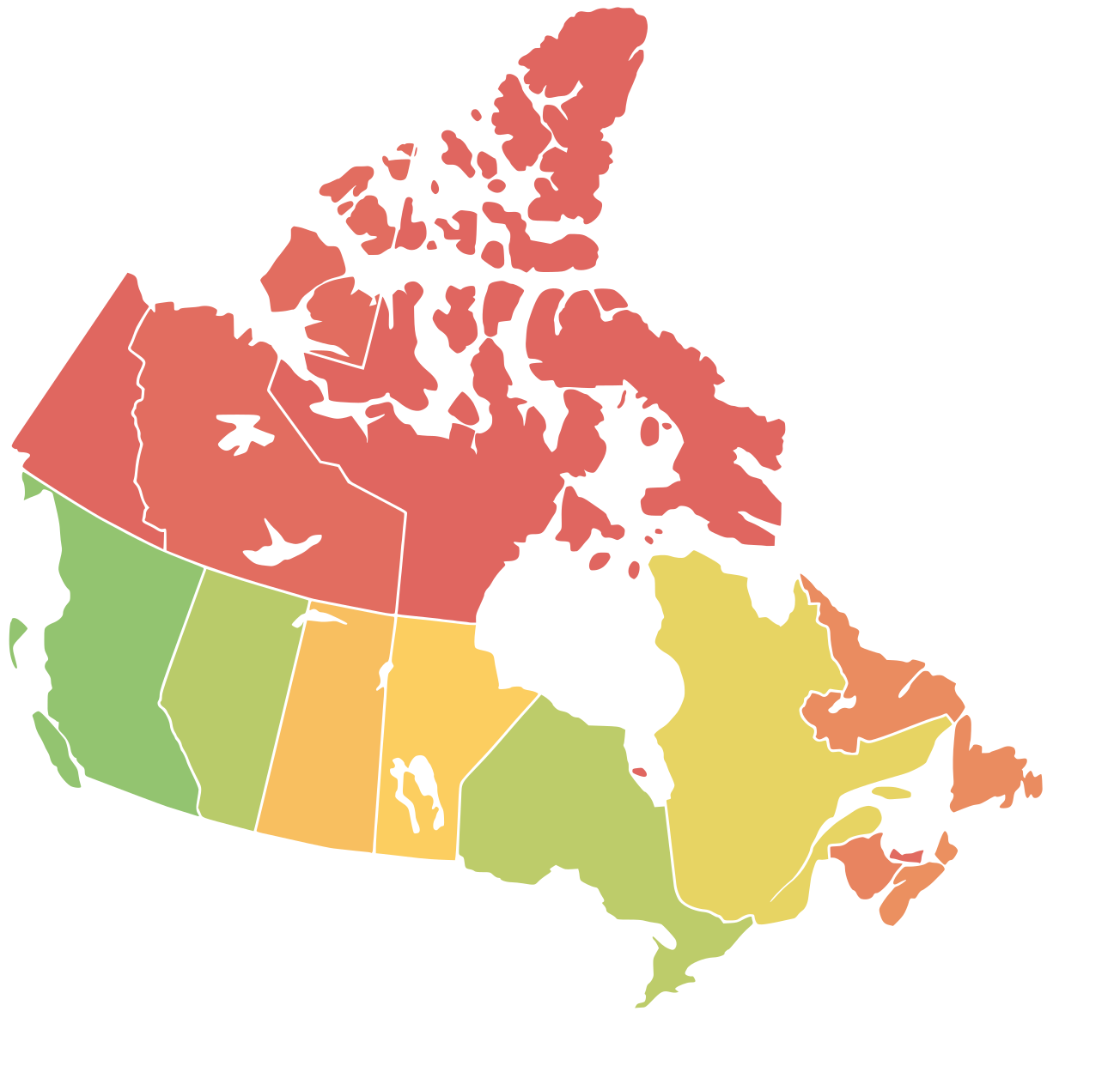
English: A map of Canda with a colored representation of the population per senator in each region. Red=Least Population (=> overrepresented), Yellow=Average, Green=Most Population (=> underrepresented) |
| Date | |
| Source | Based on Numbers from Wikipedia and a blank map of Canada (File:Canada_blank_map.svg) |
| Author | Moritz Ahrens, Lokal_Profil, Paul Robinson |
Licensing
This file is licensed under the Creative Commons Attribution-Share Alike 4.0 International license.
- You are free:
- to share – to copy, distribute and transmit the work
- to remix – to adapt the work
- Under the following conditions:
- attribution – You must give appropriate credit, provide a link to the license, and indicate if changes were made. You may do so in any reasonable manner, but not in any way that suggests the licensor endorses you or your use.
- share alike – If you remix, transform, or build upon the material, you must distribute your contributions under the same or compatible license as the original.
File history
Click on a date/time to view the file as it appeared at that time.
| Date/Time | Dimensions | User | Comment | |
|---|---|---|---|---|
| current | 04:01, 20 May 2019 | 1,304 × 1,263 (113 KB) | Moritz157 | {{Information |description ={{en|1=A map of Canda with a colored representation of the population per senator in each region. Red=Least Population (=> overrepresented), Yellow=Average, Green=Most Population (=> underrepresented)}} |date =20.05.2019 |source =Based on Numbers from Wikipedia and a blank map of Canada (https://commons.wikimedia.org/wiki/File:Canada_blank_map.svg) |author =Moritz Ahrens, Lokal_Profil, Paul Robinson }} |
File usage
The following page uses this file: