File:Cherry County Nebraska 1919 map.jpg

Size of this preview: 800 × 457 pixels. Other resolutions: 320 × 183 pixels | 640 × 365 pixels | 1,024 × 585 pixels | 1,280 × 731 pixels | 3,743 × 2,137 pixels.
Original file (3,743 × 2,137 pixels, file size: 2.38 MB, MIME type: image/jpeg)
| This is a file from the Wikimedia Commons. The description on its description page there is shown below.
|
Summary
| Description |
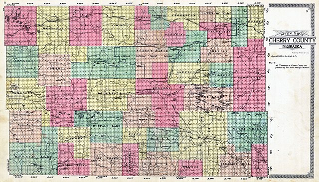
English: map of Cherry County, Nebraska, with precinct subdivision. Original size 74,30 cm x 42,43 cm. Scale 1:253440 or 1/4 of 1 inch to 1 mile) |
| Date | |
| Source | http://www.historicmapworks.com/Map/US/49291/County+Outline+Map/Cherry+County+1919/Nebraska/ |
| Author | Geo. A. Ogle and Co. (publisher) |
Licensing
|
This work is in the public domain in its country of origin and other countries and areas where the copyright term is the author's life plus 70 years or fewer. This work is in the public domain in the United States because it was published (or registered with the U.S. Copyright Office) before January 1, 1929. | |
| This file has been identified as being free of known restrictions under copyright law, including all related and neighboring rights. | |
File history
Click on a date/time to view the file as it appeared at that time.
| Date/Time | Dimensions | User | Comment | |
|---|---|---|---|---|
| current | 17:38, 30 June 2018 | 3,743 × 2,137 (2.38 MB) | Pemu | Higher Resolution. Harvested with [https://commonsarchive.wmflabs.org/wiki/File:Create_Stitch_Script_V2.ods Create Stitch Script V2] from [http://www.historicmapworks.com/Map/US/49291/County+Outline+Map/Cherry+County+1919/Nebraska/] |
File usage
The following page uses this file: