File:Circleville map.png
Size of this preview: 800 × 412 pixels. Other resolutions: 320 × 165 pixels | 640 × 330 pixels | 1,024 × 527 pixels | 1,280 × 659 pixels | 2,012 × 1,036 pixels.
Original file (2,012 × 1,036 pixels, file size: 4.1 MB, MIME type: image/png)
| This is a file from the Wikimedia Commons. The description on its description page there is shown below.
|
Summary
| Description |
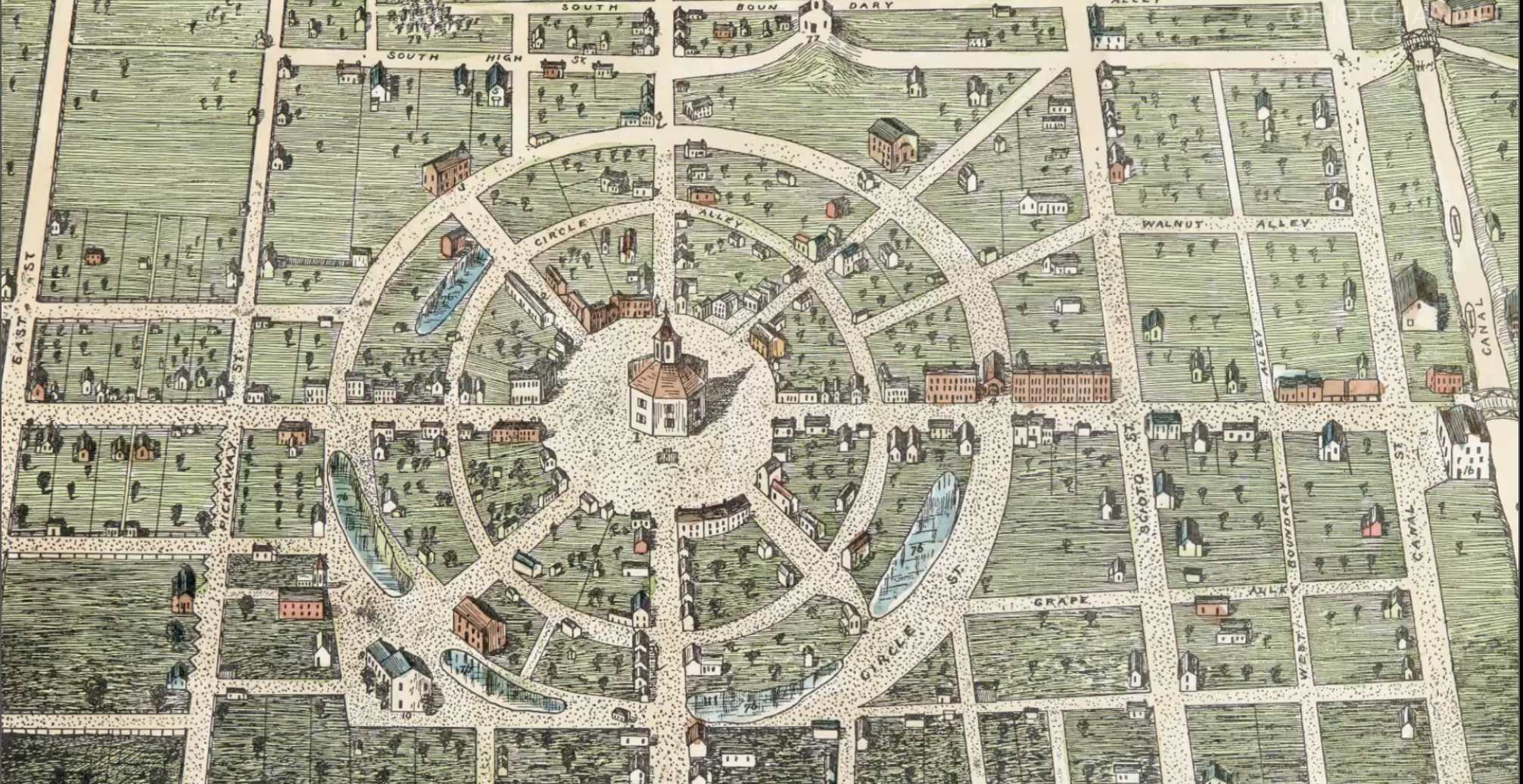
English: Map of Circleville in watercolor from c. 1836. |
| Date | circa 1836 |
| Source | http://www.ohiochannel.org/video/ohio-county-courthouses-seats-of-justice-pickaway-county |
| Author | 1836 map of Circleville by Mr. G. F. Wittich, see https://babel.hathitrust.org/cgi/pt?id=msu.31293104537158;view=1up;seq=197 page 181. |
Licensing
This work is in the public domain in the United States because it was published (or registered with the U.S. Copyright Office) before January 1, 1929.
Public domain works must be out of copyright in both the United States and in the source country of the work in order to be hosted on the Commons. If the work is not a U.S. work, the file must have an additional copyright tag indicating the copyright status in the source country.
Note: This tag should not be used for sound recordings. |
File history
Click on a date/time to view the file as it appeared at that time.
| Date/Time | Dimensions | User | Comment | |
|---|---|---|---|---|
| current | 07:50, 24 April 2018 | 2,012 × 1,036 (4.1 MB) | Ɱ | User created page with UploadWizard |
File usage
The following page uses this file: