File:Circuito Permanente del Jarama.svg

Size of this PNG preview of this SVG file: 800 × 582 pixels. Other resolutions: 320 × 233 pixels | 640 × 466 pixels | 1,024 × 745 pixels | 1,280 × 932 pixels | 1,312 × 955 pixels.
Original file (SVG file, nominally 1,312 × 955 pixels, file size: 34 KB)
| This is a file from the Wikimedia Commons. The description on its description page there is shown below.
|
Summary
| Description |
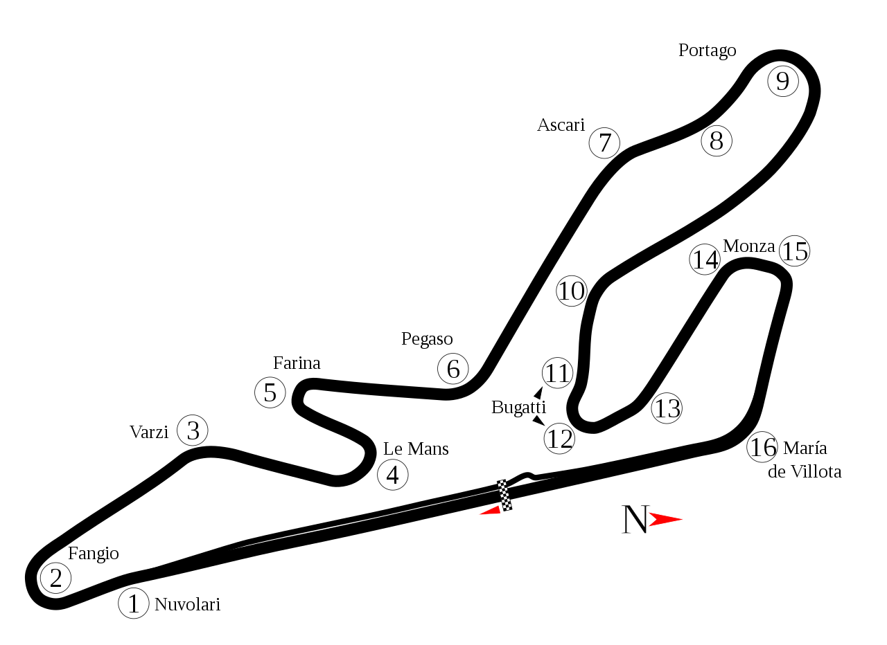
English: Track map of Circuito Permanente del Jarama. Note: The image listed below shows a section of track that doesn't appear in Google Earth. It is possible that section has been removed. |
| Date | |
| Source | Own work |
| Author | Will Pittenger |
| Other versions |
|

| Camera location | | View this and other nearby images on: OpenStreetMap |
|---|
Licensing
| I, the copyright holder of this work, release this work into the public domain. This applies worldwide. In some countries this may not be legally possible; if so: I grant anyone the right to use this work for any purpose, without any conditions, unless such conditions are required by law. |
File history
Click on a date/time to view the file as it appeared at that time.
| Date/Time | Dimensions | User | Comment | |
|---|---|---|---|---|
| current | 12:30, 9 September 2021 | 1,312 × 955 (34 KB) | Guadarrama1913 | 2017 update + minor changes |
File usage
The following page uses this file: