File:Countries by population density.svg
Original file(SVG file, nominally 6,000 × 2,647 pixels, file size: 1.62 MB)

Commons-logo.svg This is a file from the Wikimedia Commons. The description on its description page there is shown below.
Commons is a freely licensed media file repository. You can help.

Summary

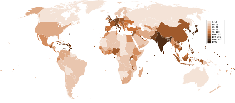
Description A map of the world, with colours to highlight the population density of each country or territory. Numbers on the legend are in people per km2, and all countries smaller than 20,000 km2 are represented by a dot. The information was taken from en:Countries by population density.It is intended as a vector replacement for Image:World population density map.PNG. It is derived from Image:BlankMap-World6.svg, so thanks to everyone who has contributed to that. If you have any comments, suggestions, corrections, or requests for other maps, please contact me at my English Wikipedia talk page.
Date
Source Own work
Author Miguel Contreras, Guatemala

Licensing

Public domain I, the copyright holder of this work, release this work into the public domain. This applies worldwide.
In some countries this may not be legally possible; if so:
I grant anyone the right to use this work for any purpose, without any conditions, unless such conditions are required by law.

Captions

Add a one-line explanation of what this file represents

10 January 2007

image/svg+xml

8b6b6f9d451e6f31f508d3c11e2664a26eb7522b

1,702,490 byte

2,647 pixel

6,000 pixel

File history

Click on a date/time to view the file as it appeared at that time.

Date/TimeDimensionsUserComment
current16:33, 21 December 20116,000 × 2,647 (1.62 MB)Quibikadded transparency

The following page uses this file:

Metadata