File:DCA airport map.PNG
Size of this preview: 391 × 600 pixels. Other resolutions: 156 × 240 pixels | 313 × 480 pixels | 807 × 1,238 pixels.
Original file (807 × 1,238 pixels, file size: 269 KB, MIME type: image/png)
| This is a file from the Wikimedia Commons. The description on its description page there is shown below.
|
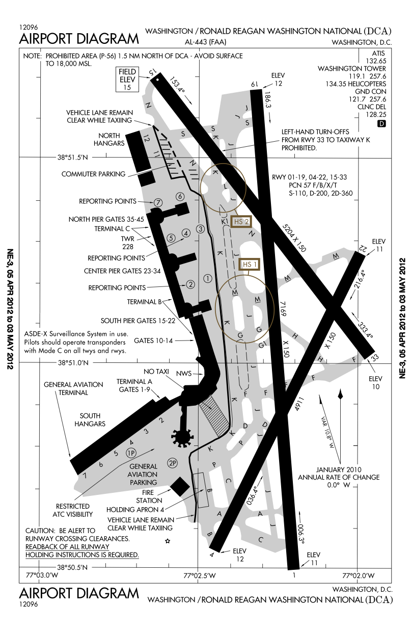
Airport diagram for Ronald Reagan Washington National Airport (Washington, D.C.)
This image or file is a work of a Federal Aviation Administration employee, taken or made as part of that person's official duties. As a work of the U.S. federal government, the image is in the public domain in the United States.
|
 |
File history
Click on a date/time to view the file as it appeared at that time.
| Date/Time | Dimensions | User | Comment | |
|---|---|---|---|---|
| current | 12:37, 12 April 2012 | 807 × 1,238 (269 KB) | Phongn | Updated to April-May 2012 map (shows longer runway) |
File usage
There are no pages that use this file.