File:Donga communes.png

Size of this preview: 776 × 600 pixels. Other resolutions: 311 × 240 pixels | 621 × 480 pixels | 994 × 768 pixels | 1,056 × 816 pixels.
Original file (1,056 × 816 pixels, file size: 26 KB, MIME type: image/png)
| This is a file from the Wikimedia Commons. The description on its description page there is shown below.
|
Summary
| Description |
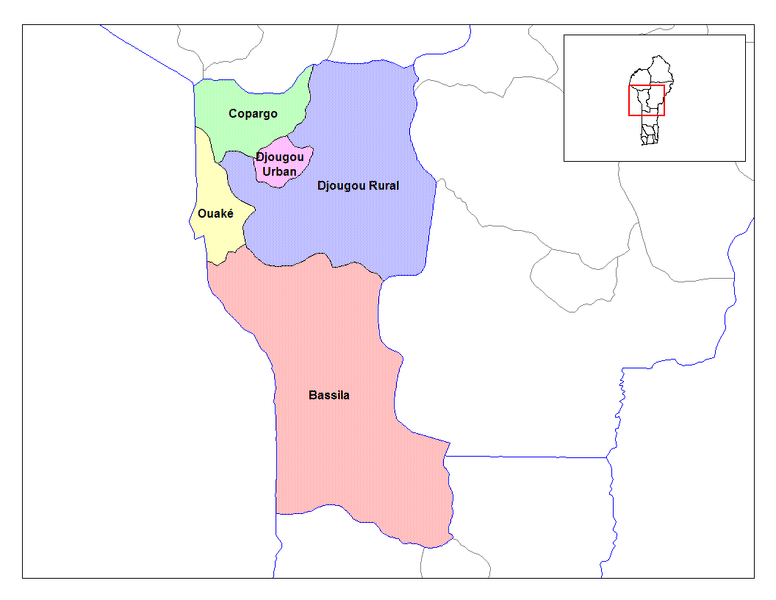
English: Map of the communes of the department of Donga, Benin. Created by Rarelibra for public domain use. Created using MapInfo Professional v7.5 and various mapping resources. |
| Date | 5 March 2006 (original upload date) |
| Source | Transferred from en.wikipedia |
| Author | Original uploader was Rarelibra at en.wikipedia |
| Permission (Reusing this file) |
Released into the public domain (by the author). |
Licensing
| |
This work has been released into the public domain by its author, Rarelibra, at the English Wikipedia project. This applies worldwide. In case this is not legally possible: |
Original upload log
The original description page was here. All following user names refer to en.wikipedia.
- 2006-03-05 02:12 Rarelibra 1056×816× (26379 bytes) Map of the communes of the department of Donga, Benin. Created by Rarelibra for public domain use. Created using MapInfo Professional v7.5 and various mapping resources.
File history
Click on a date/time to view the file as it appeared at that time.
| Date/Time | Dimensions | User | Comment | |
|---|---|---|---|---|
| current | 06:30, 31 March 2009 | 1,056 × 816 (26 KB) | Deadstar | {{Information |Description={{en|Map of the communes of the department of Donga, Benin. Created by Rarelibra for public domain use. Created using MapInfo Professional v7.5 and various mapping resources.}} |Source=Transferred from [http://en.wikipedia.org e |
File usage
The following page uses this file: