File:Donington as of 2006.svg

Size of this PNG preview of this SVG file: 800 × 555 pixels. Other resolutions: 320 × 222 pixels | 640 × 444 pixels | 1,024 × 710 pixels | 1,280 × 888 pixels | 1,338 × 928 pixels.
Original file (SVG file, nominally 1,338 × 928 pixels, file size: 44 KB)
| This is a file from the Wikimedia Commons. The description on its description page there is shown below.
|
Summary
| Description |
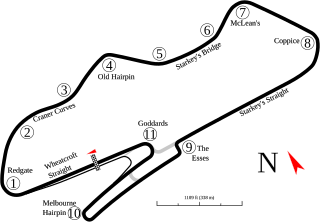
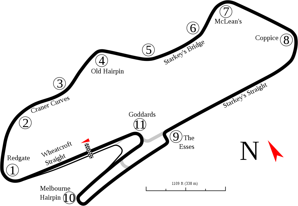
English: Track map for Donington Park as of 2006. This may or may not be the current version of the track. Changes are expected by w:2010. This is as shown in Google Earth as of the creation date. |
| Date | 9-2-2008 |
| Source | Own work |
| Author | Will Pittenger |
| Other versions |
Derivative works of this file: Donington as of 2010.svg
|

This W3C-unspecified vector image was created with Inkscape .
| Camera location | | View this and other nearby images on: OpenStreetMap |
|---|
Licensing
I, the copyright holder of this work, hereby publish it under the following license:
This file is licensed under the Creative Commons Attribution-Share Alike 3.0 Unported license.
- You are free:
- to share – to copy, distribute and transmit the work
- to remix – to adapt the work
- Under the following conditions:
- attribution – You must give appropriate credit, provide a link to the license, and indicate if changes were made. You may do so in any reasonable manner, but not in any way that suggests the licensor endorses you or your use.
- share alike – If you remix, transform, or build upon the material, you must distribute your contributions under the same or compatible license as the original.
File history
Click on a date/time to view the file as it appeared at that time.
| Date/Time | Dimensions | User | Comment | |
|---|---|---|---|---|
| current | 11:04, 7 June 2016 | 1,338 × 928 (44 KB) | Gpmat | Brigge→Bridge |
File usage
The following 3 pages use this file: