File:Dorchester 1858.jpg

Size of this preview: 637 × 600 pixels. Other resolutions: 255 × 240 pixels | 510 × 480 pixels | 682 × 642 pixels.
Original file (682 × 642 pixels, file size: 391 KB, MIME type: image/jpeg)
| This is a file from the Wikimedia Commons. The description on its description page there is shown below.
|
Summary
| Description |
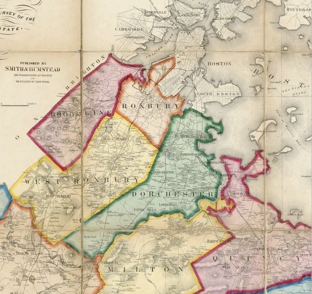
English: Map of Dorchester, Massachusetts and surrounding area from H. F. Walling Map of the County of Norfolk, Massachusetts, 1858. |
| Date | |
| Source | David Rumsey Collection, http://www.davidrumsey.com |
| Author | Walling, H. F. |
| This is a retouched picture, which means that it has been digitally altered from its original version. Modifications: This is a cropped image of the full size Norfolk County map..
|
Licensing
This file is licensed under the Creative Commons Attribution-Share Alike 3.0 Unported license.
- You are free:
- to share – to copy, distribute and transmit the work
- to remix – to adapt the work
- Under the following conditions:
- attribution – You must give appropriate credit, provide a link to the license, and indicate if changes were made. You may do so in any reasonable manner, but not in any way that suggests the licensor endorses you or your use.
- share alike – If you remix, transform, or build upon the material, you must distribute your contributions under the same or compatible license as the original.
File history
Click on a date/time to view the file as it appeared at that time.
| Date/Time | Dimensions | User | Comment | |
|---|---|---|---|---|
| current | 18:45, 6 November 2008 | 682 × 642 (391 KB) | Sswonk | {{Information |Description={{en|1=Map of Dorchester, Massachusetts and surrounding area from H. F. Walling Map of the County of Norfolk, Massachusetts, 1858.}} |Source=David Rumsey Collection, http://www.davidrumsey.com |Author=Walling, H. F. |Date=1858 | |
File usage
The following 2 pages use this file: