File:East Timor Baucau locator map 2003-2015.svg

Size of this PNG preview of this SVG file: 799 × 353 pixels. Other resolutions: 320 × 141 pixels | 640 × 283 pixels | 1,024 × 452 pixels | 1,280 × 566 pixels | 1,607 × 710 pixels.
Original file (SVG file, nominally 1,607 × 710 pixels, file size: 127 KB)
| This is a file from the Wikimedia Commons. The description on its description page there is shown below.
|
| Description |
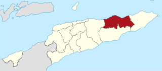
Deutsch: Lagekarte des Distrikts Baucau, Osttimor
English: Locator map of Baucau district, East Timor |
||
| Date | |||
| Source |
self-made, using |
||
| Author | NordNordWest | ||
| Permission (Reusing this file) |
I, the copyright holder of this work, hereby publish it under the following licenses:
This file is licensed under the Creative Commons Attribution 3.0 Unported license.
You may select the license of your choice. |


|
This map has been made or improved in the German Kartenwerkstatt (Map Lab). You can propose maps to improve as well.
|
File history
Click on a date/time to view the file as it appeared at that time.
| Date/Time | Dimensions | User | Comment | |
|---|---|---|---|---|
| current | 14:06, 27 May 2009 | 1,607 × 710 (127 KB) | NordNordWest | {{Information |Description= {{de|Lagekarte des Distrikts Baucau, Osttimor}} {{en|Locator map of Baucau district, East Timor}} |Source=self-made, using * East Timor location map.svg |Date=28-05-2009 |Author=[[User:Nor |
File usage
There are no pages that use this file.