File:Espmans karta.jpg
Size of this preview: 418 × 599 pixels. Other resolutions: 167 × 240 pixels | 335 × 480 pixels | 418 × 600 pixels | 536 × 768 pixels | 714 × 1,024 pixels | 2,456 × 3,520 pixels.
Original file (2,456 × 3,520 pixels, file size: 1.85 MB, MIME type: image/jpeg)
| This is a file from the Wikimedia Commons. The description on its description page there is shown below.
|
Summary
| Description |
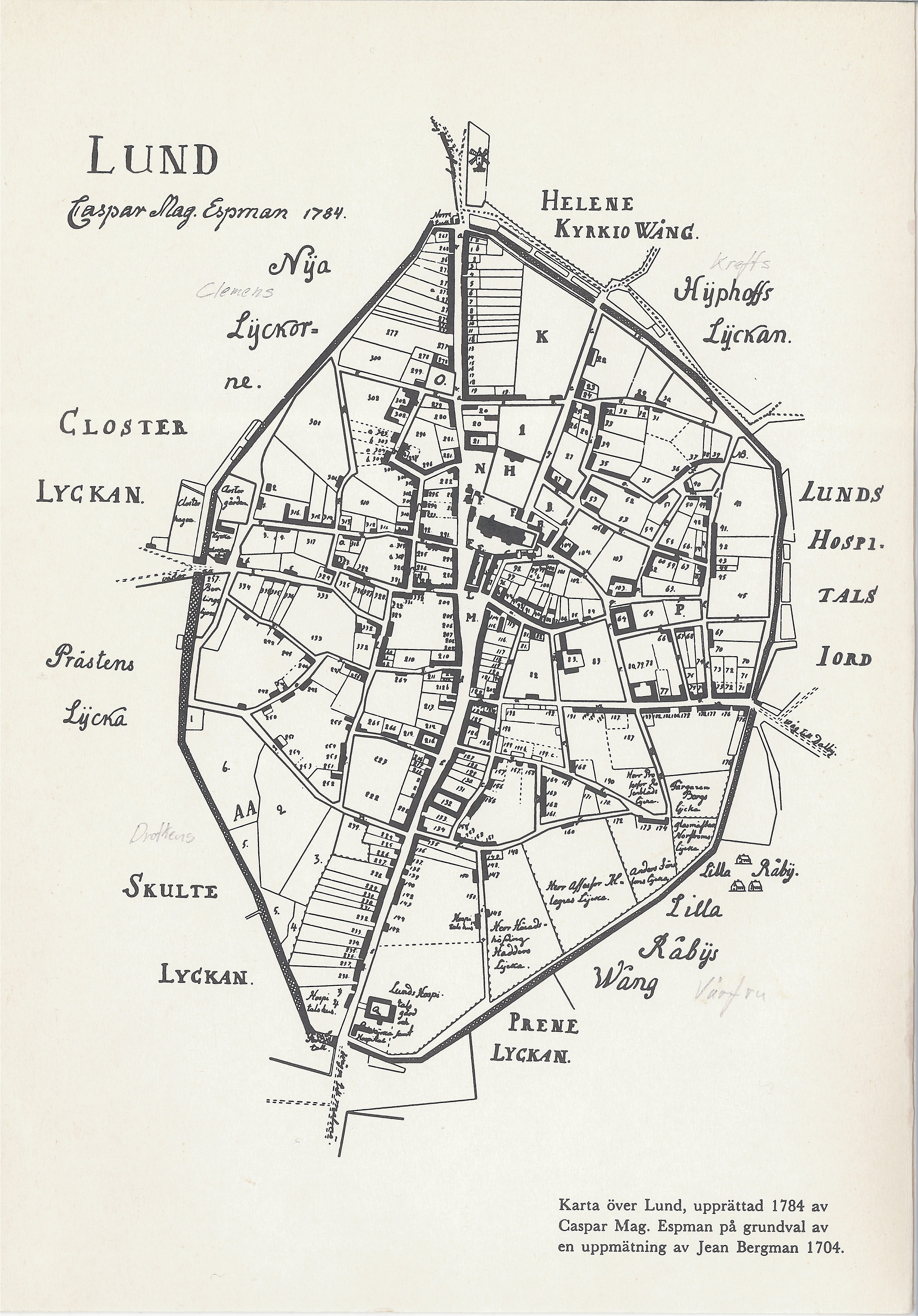
Svenska: Caspar Magnus Espmans karta över Lund, med den tidens fastighetsindelning. |
| Date | |
| Source | Lunds bevaringsprogram |
| Author | Caspar Magnus Espman |
Licensing
|
This work is in the public domain in its country of origin and other countries and areas where the copyright term is the author's life plus 100 years or fewer. | |
| This file has been identified as being free of known restrictions under copyright law, including all related and neighboring rights. | |
File history
Click on a date/time to view the file as it appeared at that time.
| Date/Time | Dimensions | User | Comment | |
|---|---|---|---|---|
| current | 06:52, 21 April 2011 | 2,456 × 3,520 (1.85 MB) | Grillo | {{Information |Description ={{sv|1=Caspar Magnus Espmans karta över Lund, med den tidens fastighetsindelning.}} |Source =Lunds bevaringsprogram |Author =Caspar Magnus Espman |Date =1784 |Permission = |other_versions = }} |
File usage
The following page uses this file: