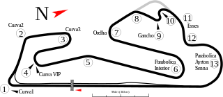
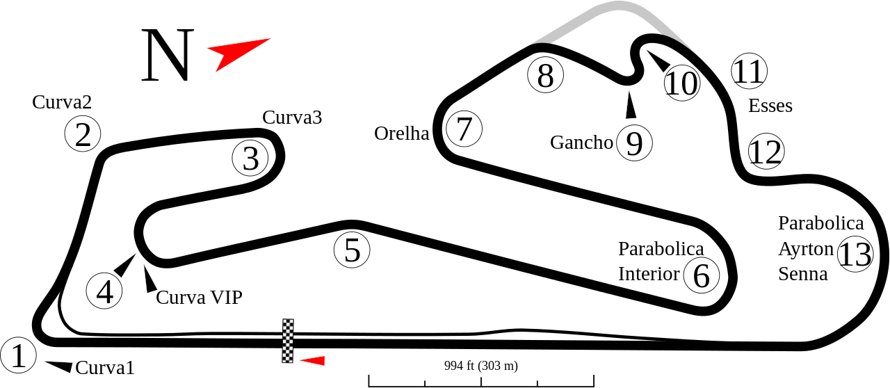
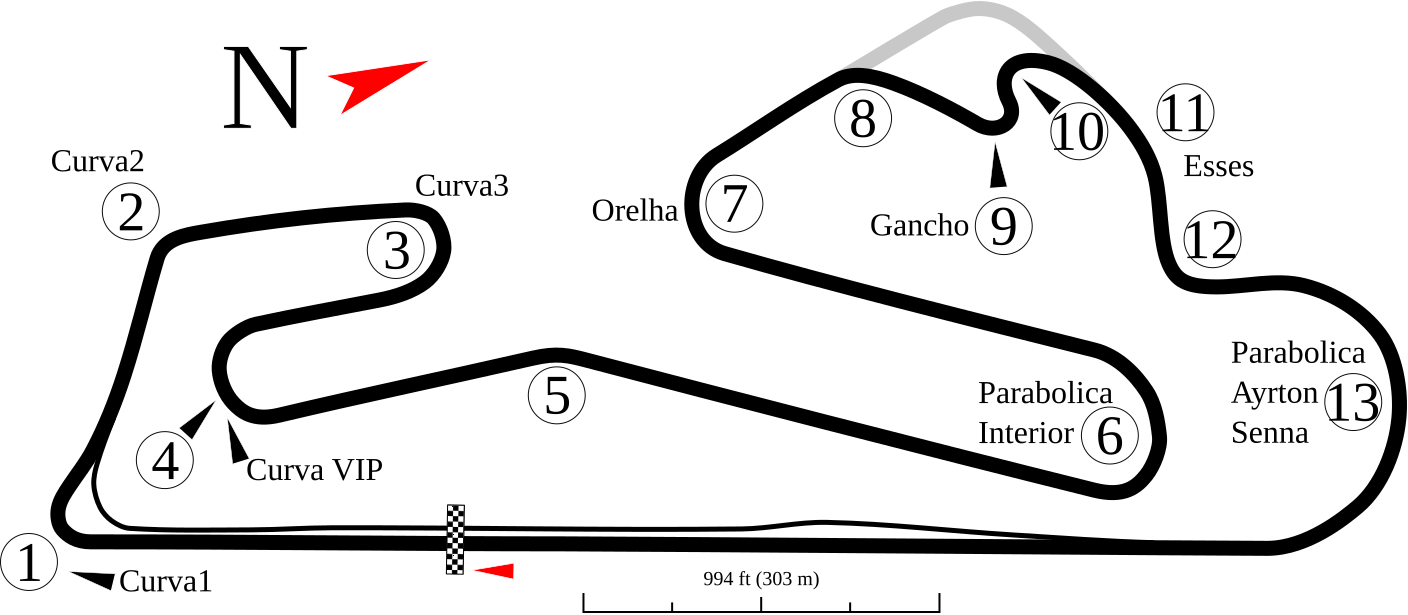
File:Estoril track map.svg

Size of this PNG preview of this SVG file: 800 × 349 pixels. Other resolutions: 320 × 140 pixels | 640 × 279 pixels | 1,024 × 447 pixels | 1,280 × 558 pixels | 1,408 × 614 pixels.
Original file (SVG file, nominally 1,408 × 614 pixels, file size: 49 KB)
| This is a file from the Wikimedia Commons. The description on its description page there is shown below.
|
Summary
| Description |
English: Track map of Estoril. Italiano: Mappa del circuito di Estoril in portogallo |
| Date | 10-2-2008 |
| Source | Own work |
| Author | Will Pittenger |
This W3C-unspecified vector image was created with Inkscape .
| Camera location | | View this and other nearby images on: OpenStreetMap |
|---|
Licensing
I, the copyright holder of this work, hereby publish it under the following license:
This file is licensed under the Creative Commons Attribution-Share Alike 3.0 Unported license.
- You are free:
- to share – to copy, distribute and transmit the work
- to remix – to adapt the work
- Under the following conditions:
- attribution – You must give appropriate credit, provide a link to the license, and indicate if changes were made. You may do so in any reasonable manner, but not in any way that suggests the licensor endorses you or your use.
- share alike – If you remix, transform, or build upon the material, you must distribute your contributions under the same or compatible license as the original.
File history
Click on a date/time to view the file as it appeared at that time.
| Date/Time | Dimensions | User | Comment | |
|---|---|---|---|---|
| current | 11:14, 21 October 2008 | 1,408 × 614 (49 KB) | Will Pittenger | New version attempts to fix how two lines were ending up on top of one another. |
File usage
The following 2 pages use this file: