File:Europe 814.png

Size of this preview: 777 × 600 pixels. Other resolutions: 311 × 240 pixels | 622 × 480 pixels | 995 × 768 pixels | 1,280 × 988 pixels | 1,393 × 1,075 pixels.
Original file (1,393 × 1,075 pixels, file size: 169 KB, MIME type: image/png)
| This is a file from the Wikimedia Commons. The description on its description page there is shown below.
|

Summary
| Description |
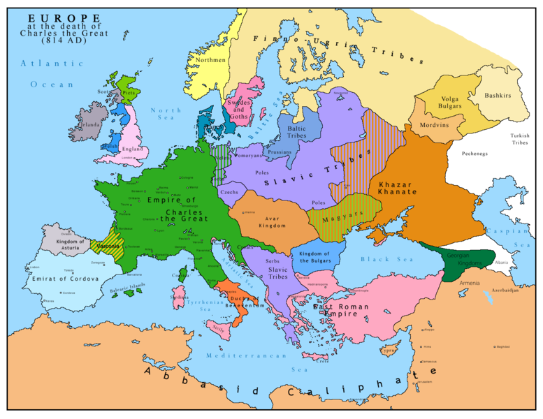
English: Map of Europe after the death of Charles the Great (814 AD). Original map made by Charles Colbeck, The Public Schools Historical Atlas (1905). |
|||
| Date | 2009-04-15. Source date: 1905 by Longmans, Green; New York, London, Bombay 1905. | |||
| Source | Own work based on: Europe 814.jpg | |||
| Author | Bukkia (talk · contribs) | |||
| Other versions |
|


Licensing
| I, the copyright holder of this work, release this work into the public domain. This applies worldwide. In some countries this may not be legally possible; if so: I grant anyone the right to use this work for any purpose, without any conditions, unless such conditions are required by law. |
_en.png)
.png)
.jpg)
File history
Click on a date/time to view the file as it appeared at that time.
| Date/Time | Dimensions | User | Comment | |
|---|---|---|---|---|
| current | 04:09, 26 April 2023 | 1,393 × 1,075 (169 KB) | OrionNimrod | Reverted to version as of 13:52, 23 December 2015 (UTC) restore |
File usage
There are no pages that use this file.