File:Eyre lake map of the shape and depth (bathymetry) 2020.jpg
No higher resolution available.
Eyre_lake_map_of_the_shape_and_depth_(bathymetry)_2020.jpg (720 × 545 pixels, file size: 147 KB, MIME type: image/jpeg)
| This is a file from the Wikimedia Commons. The description on its description page there is shown below.
|
_2020.jpg)
Summary
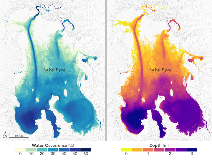
| Description |
English: Eyre lake map of the shape and depth (bathymetry) 2020 |
| Date | |
| Source | https://earthobservatory.nasa.gov/images/148230/sizing-up-remote-lakes |
| Author | NASA |
Licensing
| This file is in the public domain in the United States because it was solely created by NASA. NASA copyright policy states that "NASA material is not protected by copyright unless noted". (See Template:PD-USGov, NASA copyright policy page or JPL Image Use Policy.) | ||
 |
Warnings:
|
File history
Click on a date/time to view the file as it appeared at that time.
| Date/Time | Dimensions | User | Comment | |
|---|---|---|---|---|
| current | 12:44, 27 April 2021 | 720 × 545 (147 KB) | Artem.G | Uploaded a work by NASA from https://earthobservatory.nasa.gov/images/148230/sizing-up-remote-lakes with UploadWizard |
_2020.jpg)