File:Fog in the Tay estuary - geograph.org.uk - 9750.jpg
No higher resolution available.
Fog_in_the_Tay_estuary_-_geograph.org.uk_-_9750.jpg (640 × 480 pixels, file size: 102 KB, MIME type: image/jpeg)
| This is a file from the Wikimedia Commons. The description on its description page there is shown below.
|
Summary
| Description |
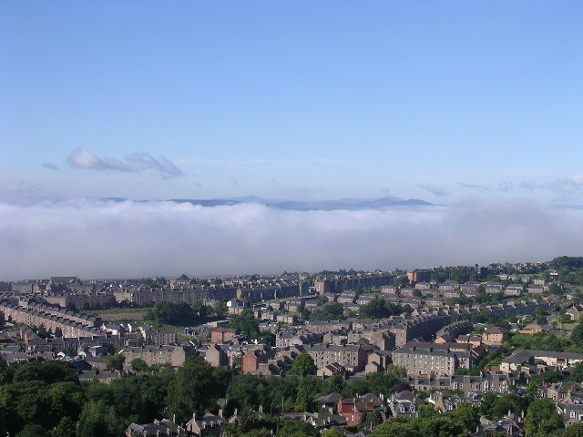
English: Fog in the Tay estuary. This view south from the summit of Dundee law shows a temperature inversion in the river estuary. Normally it is possible to see across the river to Fife. On this June morning cold air had crept from the sea into the river mouth (not an uncommon event especially in summer when sea haar spoils many a fine day in Dundee) and only a tiny fragment of Fife is visible above it. |
| Date | |
| Source | From geograph.org.uk |
| Author | Val Vannet |
| Attribution (required by the license) | Val Vannet / Fog in the Tay estuary / |
| Camera location | | View this and other nearby images on: OpenStreetMap |
|---|
_heading:180.00&language=en)
| Object location | | View this and other nearby images on: OpenStreetMap |
|---|
_heading:180.00&language=en)
Licensing

|
This image was taken from the Geograph project collection. See this photograph's page on the Geograph website for the photographer's contact details. The copyright on this image is owned by Val Vannet and is licensed for reuse under the Creative Commons Attribution-ShareAlike 2.0 license.
|
This file is licensed under the Creative Commons Attribution-Share Alike 2.0 Generic license.
Attribution: Val Vannet
- You are free:
- to share – to copy, distribute and transmit the work
- to remix – to adapt the work
- Under the following conditions:
- attribution – You must give appropriate credit, provide a link to the license, and indicate if changes were made. You may do so in any reasonable manner, but not in any way that suggests the licensor endorses you or your use.
- share alike – If you remix, transform, or build upon the material, you must distribute your contributions under the same or compatible license as the original.
File history
Click on a date/time to view the file as it appeared at that time.
| Date/Time | Dimensions | User | Comment | |
|---|---|---|---|---|
| current | 18:30, 29 January 2010 | 640 × 480 (102 KB) | GeographBot | == {{int:filedesc}} == {{Information |description={{en|1=Fog in the Tay estuary. This view south from the summit of Dundee law shows a temperature inversion in the river estuary. Normally it is possible to see across the river to Fife. On this June morn |
File usage
The following page uses this file: