File:Gate Montpellier.jpg
Size of this preview: 800 × 600 pixels. Other resolutions: 320 × 240 pixels | 640 × 480 pixels | 1,024 × 768 pixels | 1,280 × 960 pixels | 1,632 × 1,224 pixels.
Original file (1,632 × 1,224 pixels, file size: 636 KB, MIME type: image/jpeg)
| This is a file from the Wikimedia Commons. The description on its description page there is shown below.
|
Summary
| Description |
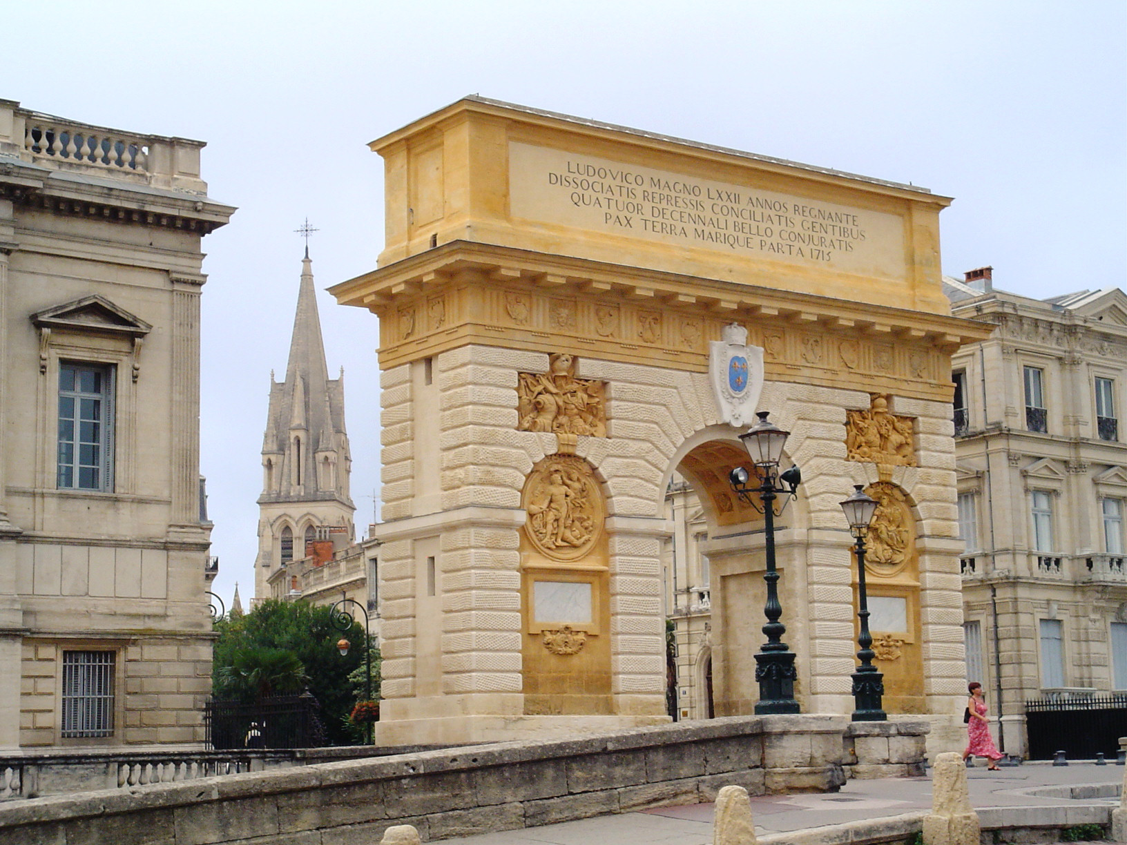
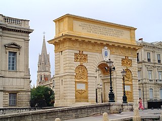
English: The triumphal arch of Peyrou, commissioned by Louis XIV, marks the entrance of the city of Montpellier.
The Latin inscription reads, Ludovico Magno LXXII annos egnante dissociatis repressis conciliatis gentibus quartet ecennali pax bello conjuratis terra marique parta 1715 Translation: "Louis the Great reigned for 72 years, the nations who betrayed the alliance have been repressed and are reconciled to those who were united by oath during a war of four decades; peace has been made on land and sea, in 1715."Français : L'arc de triomphe du Peyrou, commandé par Louis XIV, marque l'entrée du centre-ville de Montpellier. L'inscription latine : Ludovico Magno LXXII annos egnante dissociatis repressis conciliatis gentibus quatuor ecennali bello conjuratis pax terra marique parta 1715 Traduction : "Alors que Louis le Grand (Louis XIV) régnait depuis 72 années, alors que les nations qui ont trahi l'alliance ont été réprimées et qu'ont été conciliées celles qui s'étaient unies par le serment durant une guerre de quatre décennies, la paix a été apportée sur terre et sur mer, en 1715". |
||
| Date | |||
| Source | Own work | ||
| Author | Empoor | ||
| Permission (Reusing this file) |
|
| Camera location | | View this and other nearby images on: OpenStreetMap |
|---|
| This is a retouched picture, which means that it has been digitally altered from its original version. Modifications: reduced blue haze; brightened slightly. Modifications made by Tysto.
|
File history
Click on a date/time to view the file as it appeared at that time.
| Date/Time | Dimensions | User | Comment | |
|---|---|---|---|---|
| current | 16:40, 29 January 2006 | 1,632 × 1,224 (636 KB) | Tysto | reduced blue haze; brightened slightly |
File usage
The following page uses this file: