File:Gogebic County, MI census map.png
Size of this preview: 600 × 600 pixels. Other resolutions: 240 × 240 pixels | 480 × 480 pixels | 768 × 768 pixels | 1,024 × 1,024 pixels | 2,000 × 2,000 pixels.
Original file (2,000 × 2,000 pixels, file size: 248 KB, MIME type: image/png)
| This is a file from the Wikimedia Commons. The description on its description page there is shown below.
|
Summary
| Description |
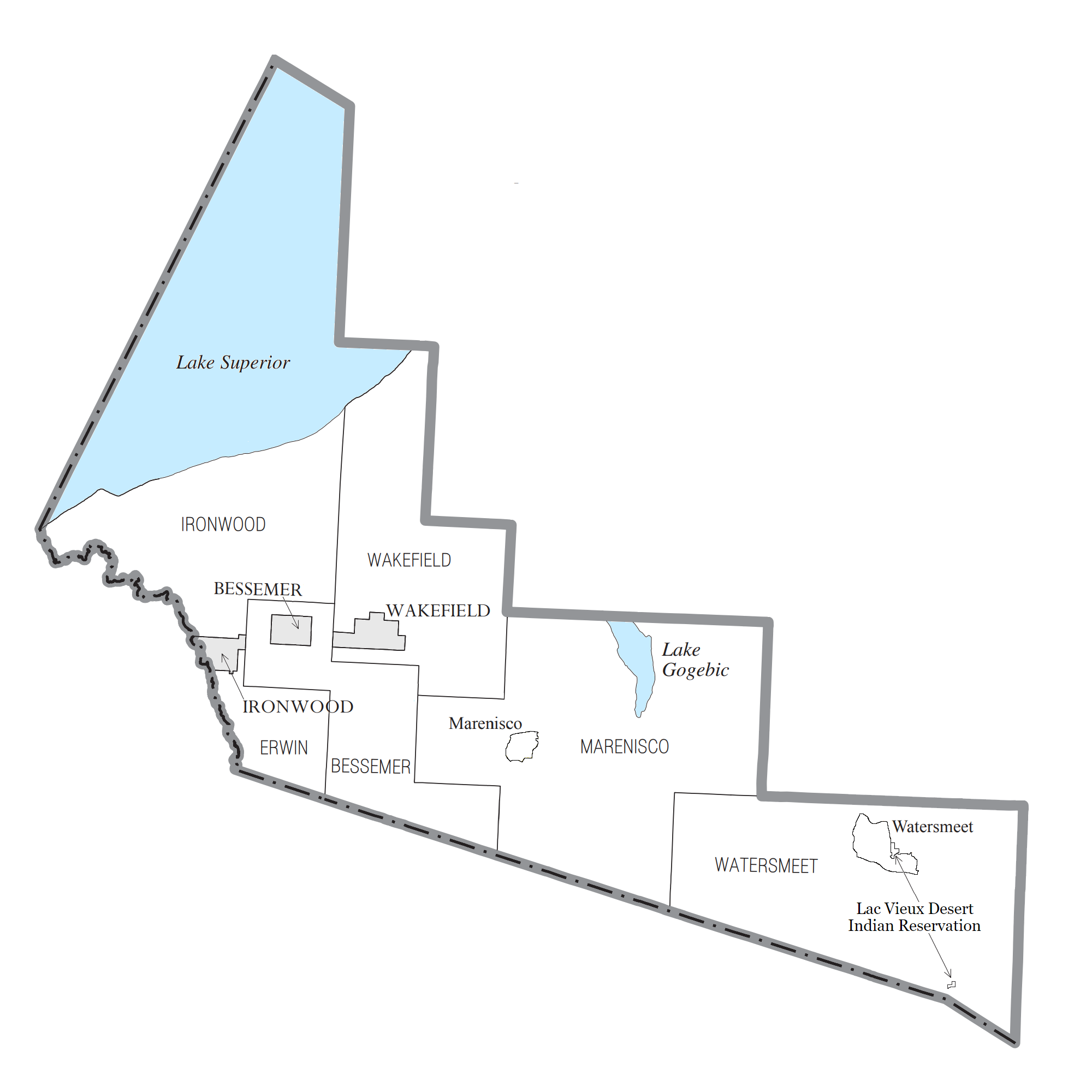
English: Gogebic County census data map |
| Date | 14:17, 11 July 2019 (UTC) |
| Source | Own work |
| Author | Notorious4life (talk) (Uploads) |
Licensing
Notorious4life at English Wikipedia, the copyright holder of this work, hereby publishes it under the following license:
| This file is made available under the Creative Commons CC0 1.0 Universal Public Domain Dedication. | |
| The person who associated a work with this deed has dedicated the work to the public domain by waiving all of their rights to the work worldwide under copyright law, including all related and neighboring rights, to the extent allowed by law. You can copy, modify, distribute and perform the work, even for commercial purposes, all without asking permission.
|
Original upload log
The original description page was here. All following user names refer to en.wikipedia.
| Date/Time | Dimensions | User | Comment |
|---|---|---|---|
| 2019-07-17 01:31 | 2000×2000× (243235 bytes) | Notorious4life | removed MI map |
| 2019-07-11 14:17 | 2100×2000× (287695 bytes) | Notorious4life | == Summary == {{Information | description = Gogebic County census data map | source = {{own}} | date = ~~~~~ | author = [[User:Notorious4life|Notorious4life]] ([[User talk:Notorious4life|talk]]) ([[Special:ListFiles/Notorious4life|Uploads]]) | permission = | other_versions = | additional_information = }} == Licensing == {{self|cc-zero}} |
File history
Click on a date/time to view the file as it appeared at that time.
| Date/Time | Dimensions | User | Comment | |
|---|---|---|---|---|
| current | 07:30, 22 January 2020 | 2,000 × 2,000 (248 KB) | Notorious4life | updated census map to outline CDPs of Marenisco and Watersmeet |
File usage
The following page uses this file: