File:Gran Colombia map.jpg

Size of this preview: 800 × 580 pixels. Other resolutions: 320 × 232 pixels | 640 × 464 pixels | 1,024 × 742 pixels | 1,280 × 928 pixels | 2,407 × 1,745 pixels.
Original file (2,407 × 1,745 pixels, file size: 1.35 MB, MIME type: image/jpeg)
| This is a file from the Wikimedia Commons. The description on its description page there is shown below.
|
Summary
| Description |
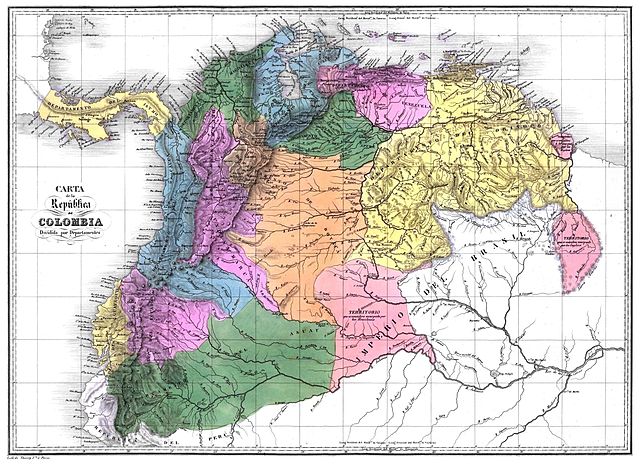
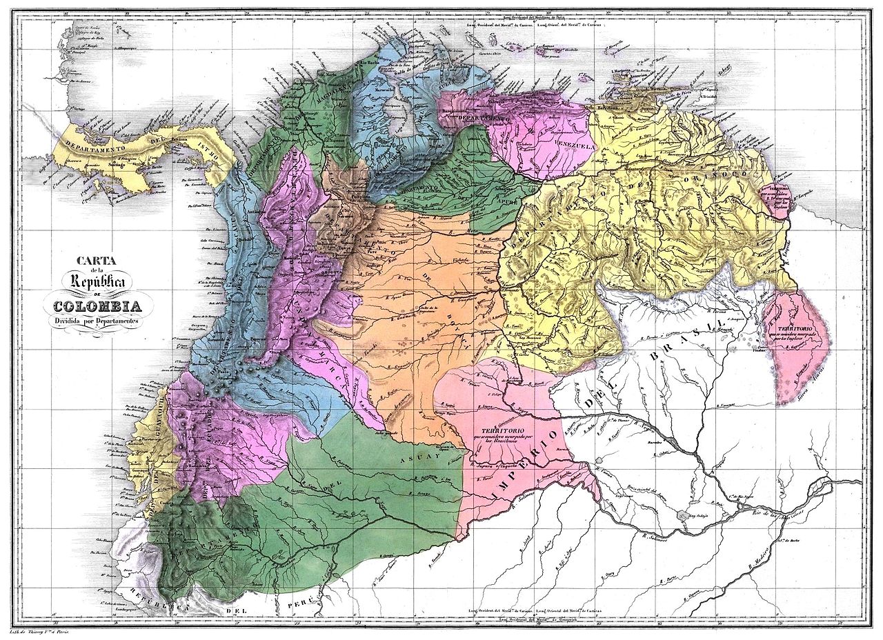
Español: Carta de la República de Colombia dividida en 12 departamentos en 1824. Tomado del Atlas físico y político de la República de Venezuela, 1840.
English: Map of the Greater Colombia
Français : Carte de la Grande Colombie
Deutsch: Diagramm des Großkolumbien |
||||||||||||||||||||
| Date | |||||||||||||||||||||
| Source | Historical Maps by Agustín Codazzi, from David Rumsey Website | ||||||||||||||||||||
| Author |
|
||||||||||||||||||||
| Permission (Reusing this file) |
|
||||||||||||||||||||
| Other versions | العربيَّة | ||||||||||||||||||||

File history
Click on a date/time to view the file as it appeared at that time.
| Date/Time | Dimensions | User | Comment | |
|---|---|---|---|---|
| current | 15:15, 27 February 2012 | 2,407 × 1,745 (1.35 MB) | Josher8a | ajuste de perspectiva, eliminación de interferencias , mejoramiento de color y borrado de marcas de los dobleces y eliminación de los mismos |
File usage
The following 2 pages use this file: