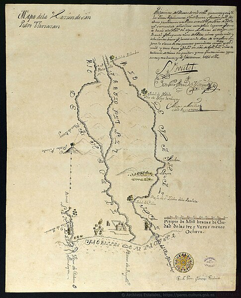
File:Hacienda San Pedro Tunasan Map.jpg
Original file(1,860 × 2,300 pixels, file size: 749 KB, MIME type: image/jpeg)

Commons-logo.svg This is a file from the Wikimedia Commons. The description on its description page there is shown below.
Commons is a freely licensed media file repository. You can help.

Summary

Description
English: The map represents the Hacienda San Pedro Tunasan, Provincia de La Laguna, Filipinas, ca. 1745
Date
Source Archivo General de Indias, Spain
Author Unknown authorUnknown author

Licensing

Public domain

This work is in the public domain in its country of origin and other countries and areas where the copyright term is the author's life plus 70 years or fewer.


You must also include a United States public domain tag to indicate why this work is in the public domain in the United States.
This file has been identified as being free of known restrictions under copyright law, including all related and neighboring rights.

Captions

Map of Hacienda San Pedro Tunasan, La Laguna, ca. 1745. From the Archivo General de Indias

Items portrayed in this file

depicts

image/jpeg

File history

Click on a date/time to view the file as it appeared at that time.

Date/TimeDimensionsUserComment
current17:54, 3 March 20241,860 × 2,300 (749 KB)MikimikitabsUploaded a work by {{Unknown|author}} from Archivo General de Indias, Spain with UploadWizard

The following page uses this file:

Metadata