File:Hangu District, Khyber Pakhtunkhwa.png
Size of this preview: 600 × 600 pixels. Other resolutions: 240 × 240 pixels | 480 × 480 pixels | 768 × 768 pixels | 1,024 × 1,024 pixels | 3,840 × 3,840 pixels.
Original file (3,840 × 3,840 pixels, file size: 1.23 MB, MIME type: image/png)
| This is a file from the Wikimedia Commons. The description on its description page there is shown below.
|
Summary
| Description |
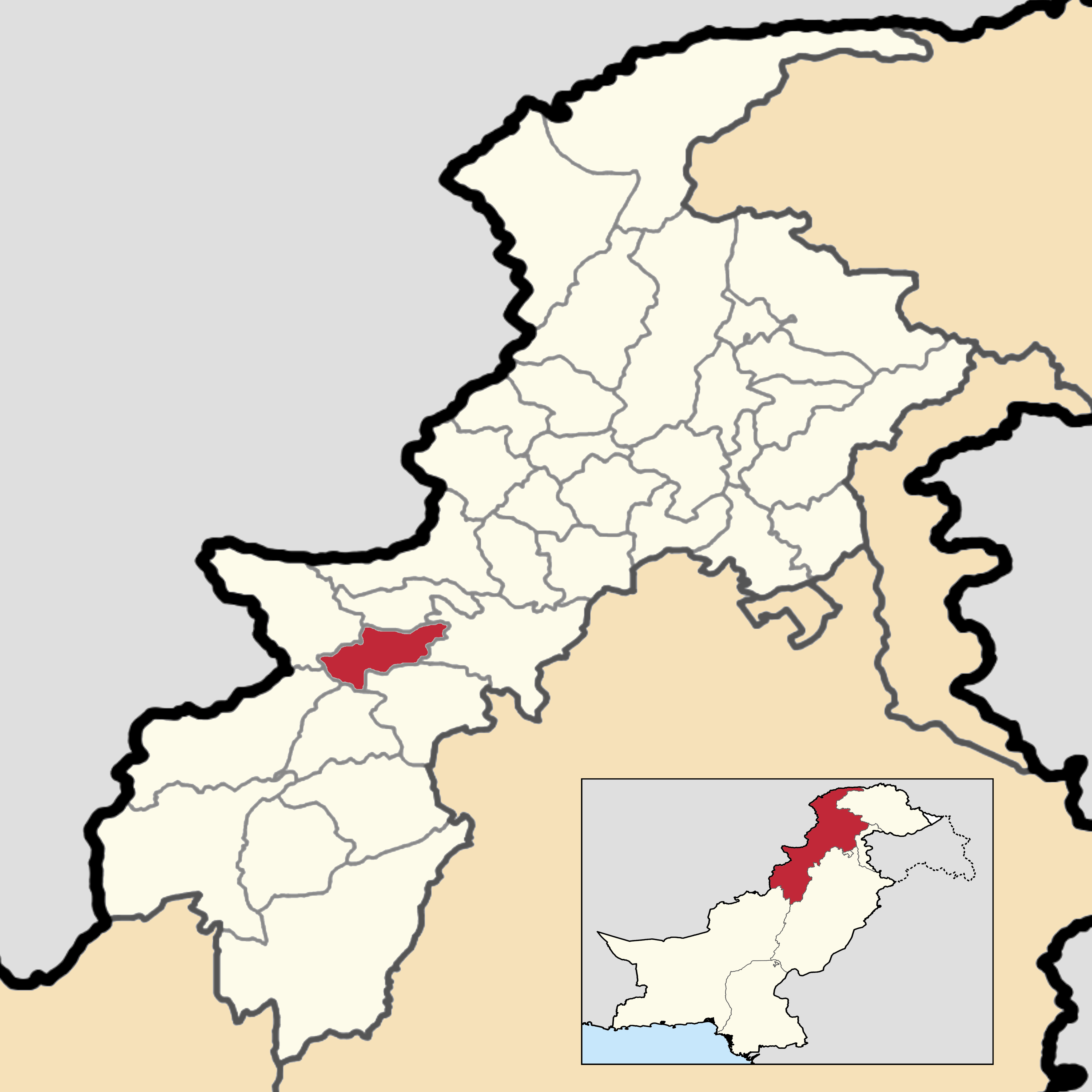
English: This is a map showing the location of Hangu District within Khyber Pakhtunkhwa Province.
You can find information about the sources used on this map, showing every district in Khyber Pakhtunkhwa Province. This map and its borders are up to date as of September 30, 2020. |
| Date | |
| Source | Own work |
| Author | User:Abbasi786786 |
Licensing
I, the copyright holder of this work, hereby publish it under the following license:
This file is licensed under the Creative Commons Attribution-Share Alike 4.0 International license.
- You are free:
- to share – to copy, distribute and transmit the work
- to remix – to adapt the work
- Under the following conditions:
- attribution – You must give appropriate credit, provide a link to the license, and indicate if changes were made. You may do so in any reasonable manner, but not in any way that suggests the licensor endorses you or your use.
- share alike – If you remix, transform, or build upon the material, you must distribute your contributions under the same or compatible license as the original.
File history
Click on a date/time to view the file as it appeared at that time.
| Date/Time | Dimensions | User | Comment | |
|---|---|---|---|---|
| current | 08:29, 16 June 2020 | 3,840 × 3,840 (1.23 MB) | Abbasi786786 | Uploaded own work with UploadWizard |
File usage
The following page uses this file: