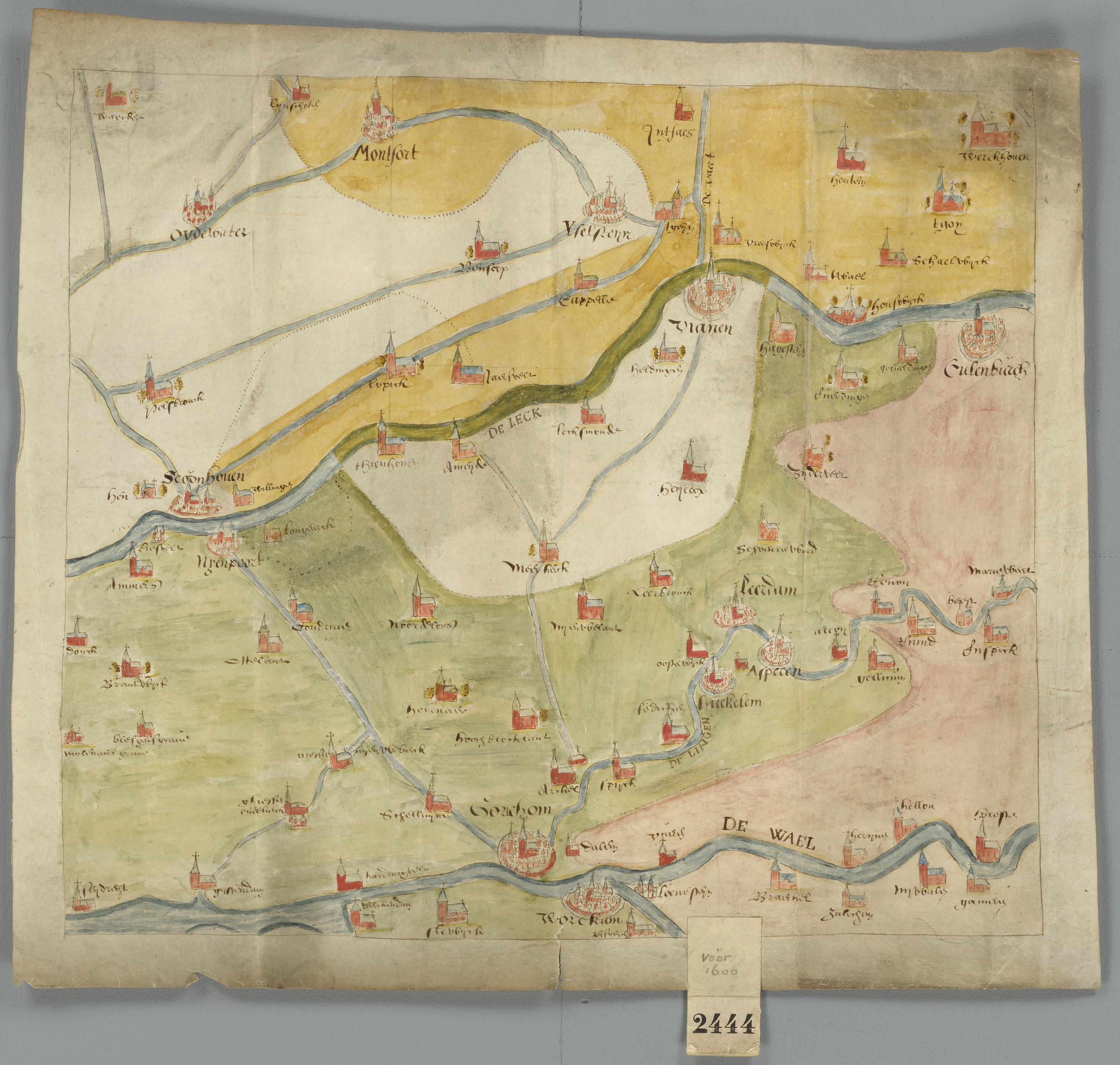
File:Historische kaart Vijfheerenlanden (16e eeuw).jpg
Size of this preview: 630 × 599 pixels. Other resolutions: 252 × 240 pixels | 505 × 480 pixels | 631 × 600 pixels | 808 × 768 pixels | 1,077 × 1,024 pixels | 2,953 × 2,808 pixels.
Original file (2,953 × 2,808 pixels, file size: 5.68 MB, MIME type: image/jpeg)
| This is a file from the Wikimedia Commons. The description on its description page there is shown below.
|
.jpg)
| Description |
Kaart van de Vijfheerenlanden en de aangrenzende landen, uit de 16de eeuw Deze kaart is onderdeel van de Verzameling Binnenlandse Kaarten Hingman. Deze collectie is door het Provinciaal Historisch Centrum Zuid-Holland gedigitaliseerd, ten behoeve van de website www.geschiedenisvanzuidholland.nl. De collectie wordt bewaard bij het Nationaal Archief. |
||||||
| Date | 16th century | ||||||
| Source | Flickr: Historische kaart Vijfheerenlanden (16e eeuw) | ||||||
| Author | Provinciaal Historisch Centrum Zuid-Holland | ||||||
| Permission (Reusing this file) |
|
||||||
| Annotations | This image is annotated: View the annotations at Commons |
File history
Click on a date/time to view the file as it appeared at that time.
| Date/Time | Dimensions | User | Comment | |
|---|---|---|---|---|
| current | 13:55, 20 October 2017 | 2,953 × 2,808 (5.68 MB) | VortBot | Uploading higher resolution from Flickr |
File usage
The following page uses this file:
.jpg)