File:Housing, Friern Barnet Road, London N11 - geograph.org.uk - 901219.jpg
No higher resolution available.
Housing,_Friern_Barnet_Road,_London_N11_-_geograph.org.uk_-_901219.jpg (640 × 426 pixels, file size: 112 KB, MIME type: image/jpeg)
| This is a file from the Wikimedia Commons. The description on its description page there is shown below.
|
Summary
| Description |
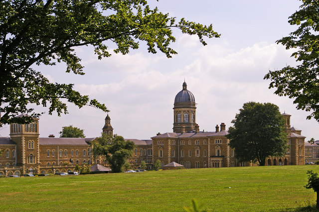
English: Housing, Friern Barnet Road, London N11 Some of the renovated buildings from the old Colney Hatch Hospital. This is a very attractive, landscaped complex.
|
|
| Date | ||
| Source | From geograph.org.uk | |
| Author | Christine Matthews | |
| Attribution (required by the license) | Christine Matthews / Housing, Friern Barnet Road, London N11 / | |
| Camera location | | View this and other nearby images on: OpenStreetMap |
|---|
_heading:202.00&language=en)
| Object location | | View this and other nearby images on: OpenStreetMap |
|---|
_heading:202.00&language=en)
Licensing

|
This image was taken from the Geograph project collection. See this photograph's page on the Geograph website for the photographer's contact details. The copyright on this image is owned by Christine Matthews and is licensed for reuse under the Creative Commons Attribution-ShareAlike 2.0 license.
|
This file is licensed under the Creative Commons Attribution-Share Alike 2.0 Generic license.
Attribution:
Christine Matthews
- You are free:
- to share – to copy, distribute and transmit the work
- to remix – to adapt the work
- Under the following conditions:
- attribution – You must give appropriate credit, provide a link to the license, and indicate if changes were made. You may do so in any reasonable manner, but not in any way that suggests the licensor endorses you or your use.
- share alike – If you remix, transform, or build upon the material, you must distribute your contributions under the same or compatible license as the original.
File history
Click on a date/time to view the file as it appeared at that time.
| Date/Time | Dimensions | User | Comment | |
|---|---|---|---|---|
| current | 11:47, 21 February 2011 | 640 × 426 (112 KB) | GeographBot | == {{int:filedesc}} == {{Information |description={{en|1=Housing, Friern Barnet Road, London N11 Some of the renovated buildings from the old Colney Hatch Hospital. This is a very attractive, landscaped complex.}} |date=2008-07-25 |source=From [http://ww |
File usage
The following page uses this file: