File:Hurricane Karl 21 sept 2004 1315Z.jpg
No higher resolution available.
Hurricane_Karl_21_sept_2004_1315Z.jpg (480 × 480 pixels, file size: 61 KB, MIME type: image/jpeg)
| This is a file from the Wikimedia Commons. The description on its description page there is shown below.
|
Summary
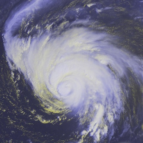
| Description | Taken from GOES-12 satellite. Hurricane Karl in the Atlantic Ocean on September 21, 2004. As of 11 AST, Karl was about 1005 miles (1620 km) ENE of the Northern Leeward Islands with sustained winds of 140 mph (225 kph) | |||
| Date | ||||
| Source | http://www.osei.noaa.gov/Events/Tropical/Atlantic/2004/TRCjeanne-karl265_G12.jpg | |||
| Author | NOAA / Operational Significant Event Imagery | |||
| Permission (Reusing this file) |
|
File history
Click on a date/time to view the file as it appeared at that time.
| Date/Time | Dimensions | User | Comment | |
|---|---|---|---|---|
| current | 17:49, 21 October 2006 | 480 × 480 (61 KB) | Good kitty | == Summary == {{Information |Description=Taken from GOES-12 satellite. Hurricane Karl in the Atlantic Ocean on September 21, 2004. As of 11 AST, Karl was about 1005 miles (1620 km) ENE of the Northern Leeward Islands with sustained winds of 140 mph (225 k |
File usage
The following page uses this file: