File:Hymenolaimus malacorhynchos - distribution map.svg

Size of this PNG preview of this SVG file: 431 × 600 pixels. Other resolutions: 172 × 240 pixels | 345 × 480 pixels | 552 × 768 pixels | 736 × 1,024 pixels | 1,181 × 1,643 pixels.
Original file (SVG file, nominally 1,181 × 1,643 pixels, file size: 102 KB)
| This is a file from the Wikimedia Commons. The description on its description page there is shown below.
|
Summary
| Description |
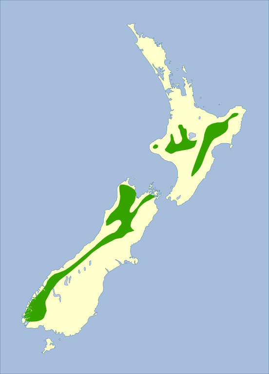
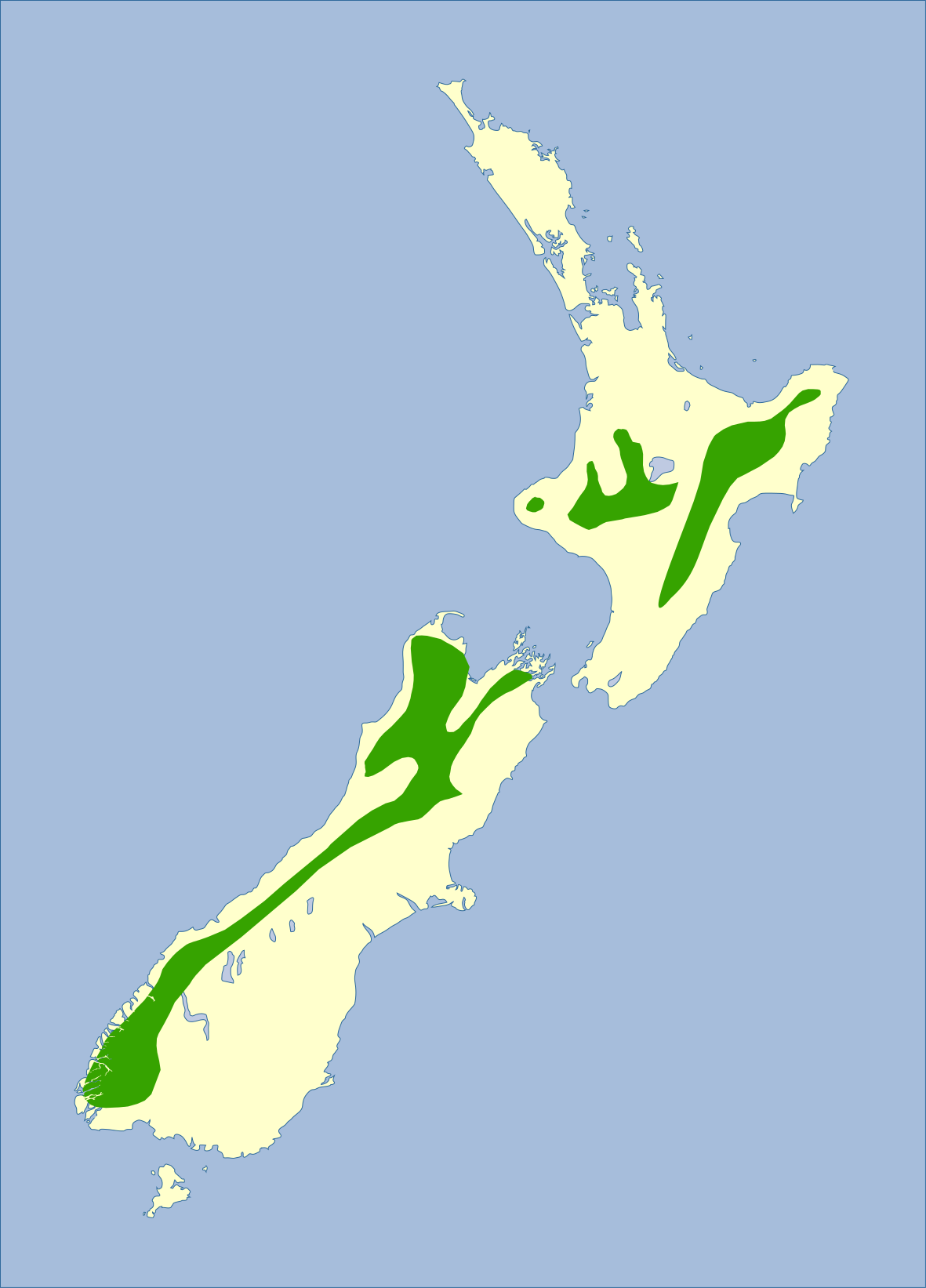
English: Blue duck (whio, Hymenolaimus malacorhynchos) distribution map.
|
| Source |
|
| Author | Created by Michal Klajban based on the mentioned resources |
Licensing

.svg)
This file is licensed under the Creative Commons Attribution-Share Alike 3.0 Unported license.
Attribution: IUCN Red List of Threatened Species, species assessors and the authors of the spatial data.
- You are free:
- to share – to copy, distribute and transmit the work
- to remix – to adapt the work
- Under the following conditions:
- attribution – You must give appropriate credit, provide a link to the license, and indicate if changes were made. You may do so in any reasonable manner, but not in any way that suggests the licensor endorses you or your use.
- share alike – If you remix, transform, or build upon the material, you must distribute your contributions under the same or compatible license as the original.
File history
Click on a date/time to view the file as it appeared at that time.
| Date/Time | Dimensions | User | Comment | |
|---|---|---|---|---|
| current | 02:50, 9 May 2020 | 1,181 × 1,643 (102 KB) | Podzemnik | a slightly different colour |
File usage
The following page uses this file: