File:I-95 flooding in Lumberton, 2016.png
Size of this preview: 800 × 373 pixels. Other resolutions: 320 × 149 pixels | 640 × 298 pixels | 1,546 × 721 pixels.
Original file (1,546 × 721 pixels, file size: 1.78 MB, MIME type: image/png)
| This is a file from the Wikimedia Commons. The description on its description page there is shown below.
|
Summary
| Description |
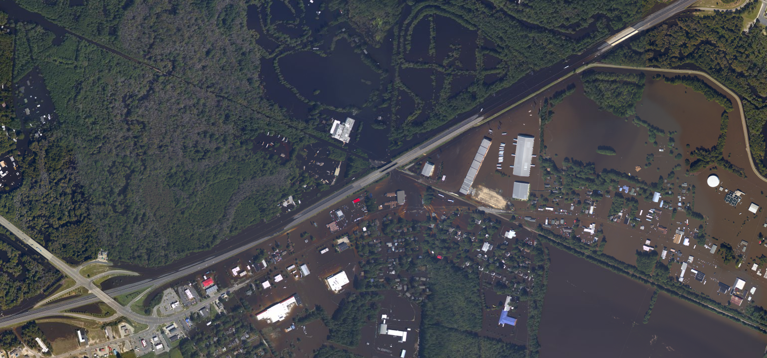
English: Flooding in Lumberton in Robeson County, North Carolina after Hurricane Matthew, on October 11 2016, just south and east of the I-95 crossing over the Lumber River. |
| Date | |
| Source | https://www.usgs.gov/media/images/hurricane-matthew-flooding-interstate-95-robeson-county-nc |
| Author | NOAA Geodetic Survey Remote Sensing Division |
Licensing
This image is in the public domain in the United States because it only contains materials that originally came from the United States Geological Survey, an agency of the United States Department of the Interior. For more information, see the official USGS copyright policy.
|
File history
Click on a date/time to view the file as it appeared at that time.
| Date/Time | Dimensions | User | Comment | |
|---|---|---|---|---|
| current | 04:41, 21 November 2022 | 1,546 × 721 (1.78 MB) | Indy beetle | Uploaded a work by NOAA Geodetic Survey Remote Sensing Division from https://www.usgs.gov/media/images/hurricane-matthew-flooding-interstate-95-robeson-county-nc with UploadWizard |
File usage
The following page uses this file: