File:IJsselkop.jpg

Size of this preview: 800 × 454 pixels. Other resolutions: 320 × 182 pixels | 640 × 364 pixels | 1,024 × 582 pixels | 1,280 × 727 pixels | 4,121 × 2,341 pixels.
Original file (4,121 × 2,341 pixels, file size: 1.66 MB, MIME type: image/jpeg)
| This is a file from the Wikimedia Commons. The description on its description page there is shown below.
|
Summary
| Description |
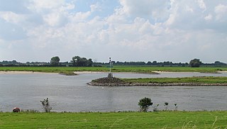
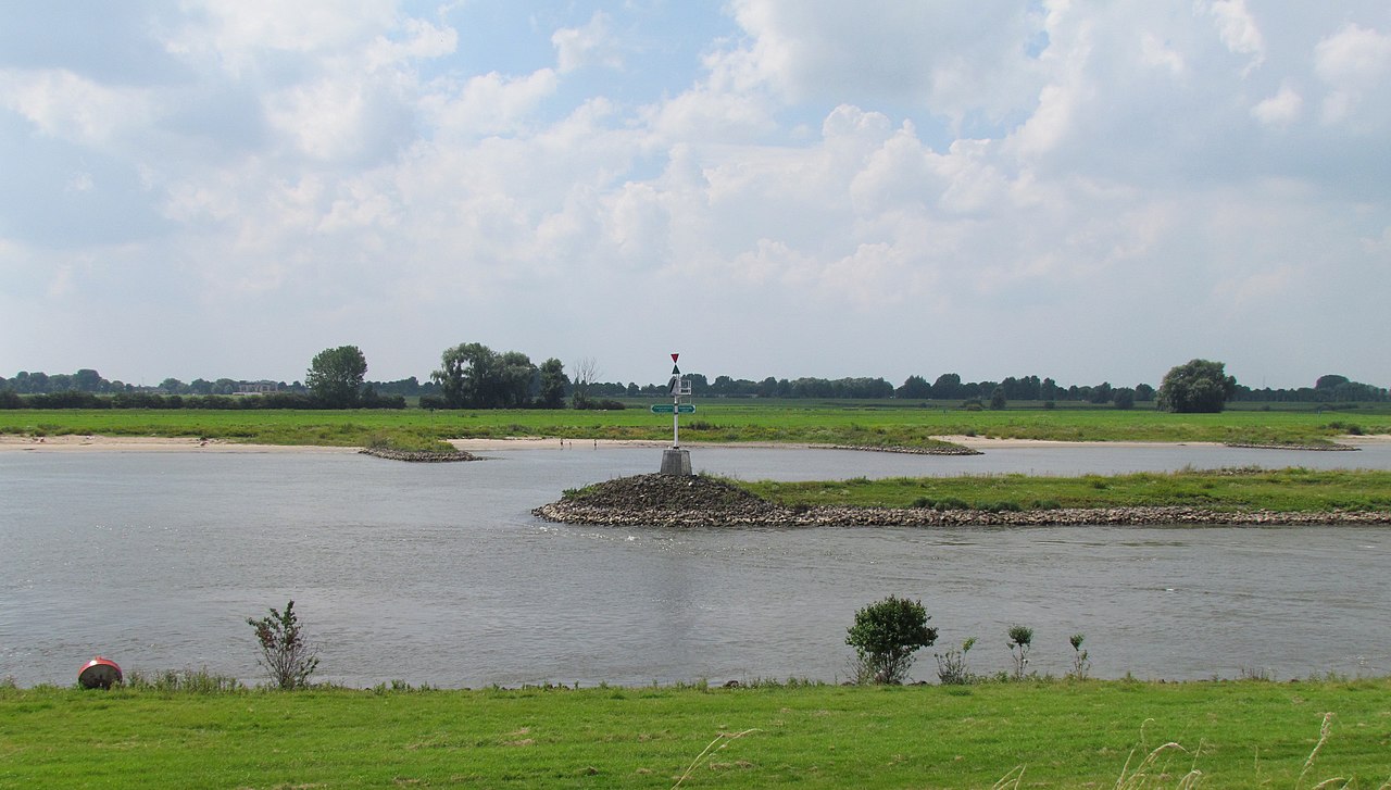
Nederlands: IJsselkop; landpunt waar de IJssel aftakt van de Neder-Rijn, tussen Westervoort, Huissen en Arnhem |
| Date | |
| Source | Own work |
| Author | Apdency |
| Object location | | View this and other nearby images on: OpenStreetMap |
|---|
Licensing
I, the copyright holder of this work, hereby publish it under the following license:
| This file is made available under the Creative Commons CC0 1.0 Universal Public Domain Dedication. | |
| The person who associated a work with this deed has dedicated the work to the public domain by waiving all of their rights to the work worldwide under copyright law, including all related and neighboring rights, to the extent allowed by law. You can copy, modify, distribute and perform the work, even for commercial purposes, all without asking permission.
|
File history
Click on a date/time to view the file as it appeared at that time.
| Date/Time | Dimensions | User | Comment | |
|---|---|---|---|---|
| current | 13:07, 7 August 2012 | 4,121 × 2,341 (1.66 MB) | Apdency | {{Information |Description={{nl|IJsselkop; landpunt waar de IJssel aftakt van de Neder-Rijn, tussen Westervoort, Huissen en Arnhem}} |Source={{own}} |Date=2012-08-05 |Author=Apdency |Permission= |other_versions= }} {{object location de... |
File usage
The following page uses this file: