File:Indiana Dunes NL parkmap east.jpg
Size of this preview: 800 × 560 pixels. Other resolutions: 320 × 224 pixels | 640 × 448 pixels | 1,024 × 717 pixels | 1,280 × 896 pixels | 2,000 × 1,400 pixels.
Original file (2,000 × 1,400 pixels, file size: 154 KB, MIME type: image/jpeg)
| This is a file from the Wikimedia Commons. The description on its description page there is shown below.
|
Summary
| Description |
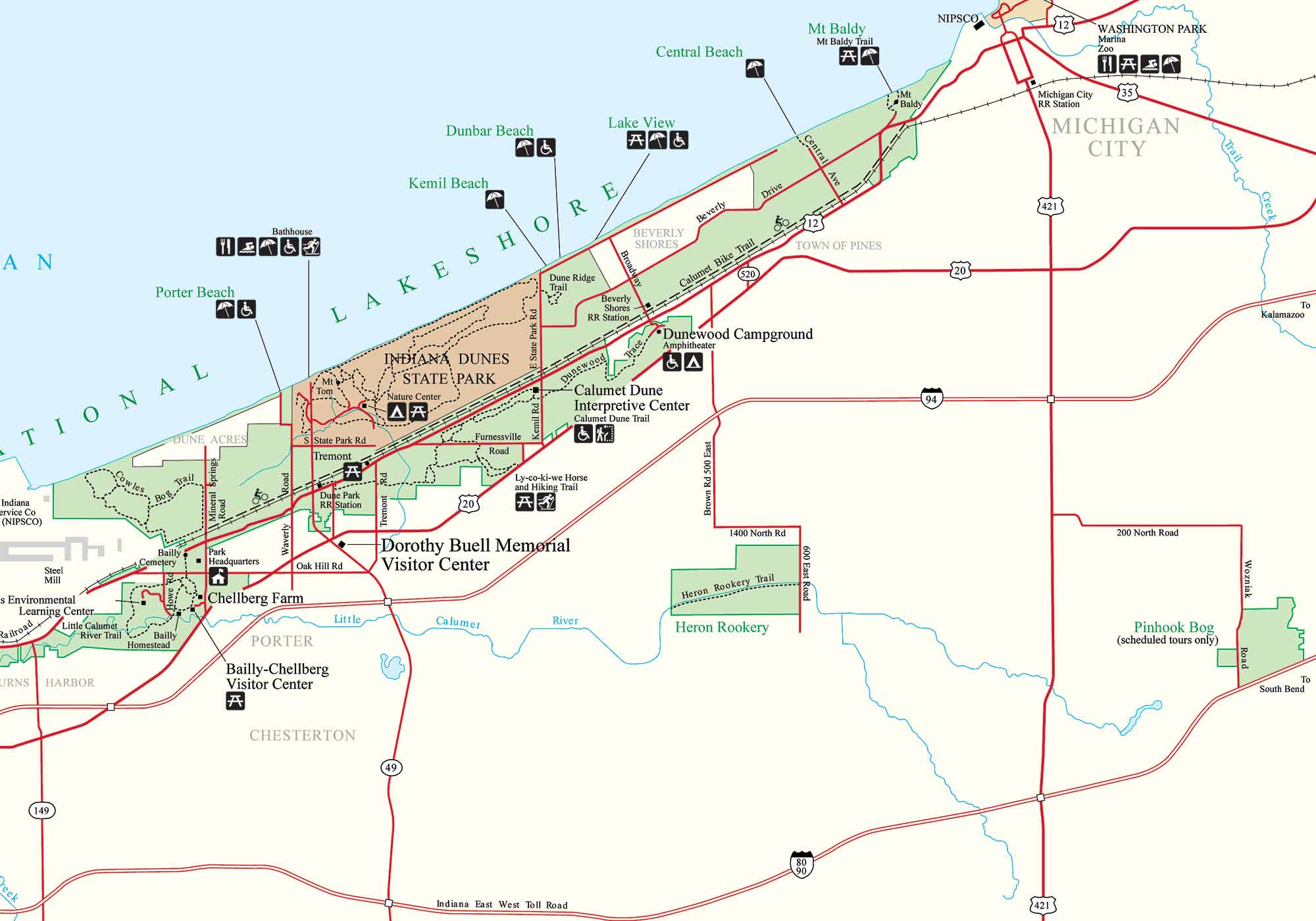
English: Map of the east portion of Indiana Dunes National Lakeshore |
| Date | Unknown date |
| Source | http://www.nps.gov/indu/planyourvisit/maps.htm |
| Author | Unknown author |
Licensing
| This image or media file contains material based on a work of a National Park Service employee, created as part of that person's official duties. As a work of the U.S. federal government, such work is in the public domain in the United States. See the NPS website and NPS copyright policy for more information. |
File history
Click on a date/time to view the file as it appeared at that time.
| Date/Time | Dimensions | User | Comment | |
|---|---|---|---|---|
| current | 10:58, 9 February 2009 | 2,000 × 1,400 (154 KB) | Chris Light | {{Information |Description=Map of the east portion of Indiana Dunes National Lakeshore |Source=http://www.nps.gov/indu/planyourvisit/maps.htm |Date=unknown |Author=unknown |Permission= |other_versions= }} |
File usage
The following page uses this file: