File:Istanbul asv2020-02 img51 Dolmabahçe Palace.jpg
Size of this preview: 800 × 500 pixels. Other resolutions: 320 × 200 pixels | 640 × 400 pixels | 1,024 × 640 pixels | 1,280 × 800 pixels | 7,791 × 4,869 pixels.
Original file (7,791 × 4,869 pixels, file size: 10.73 MB, MIME type: image/jpeg)
| This is a file from the Wikimedia Commons. The description on its description page there is shown below.
|
Summary
| Description |
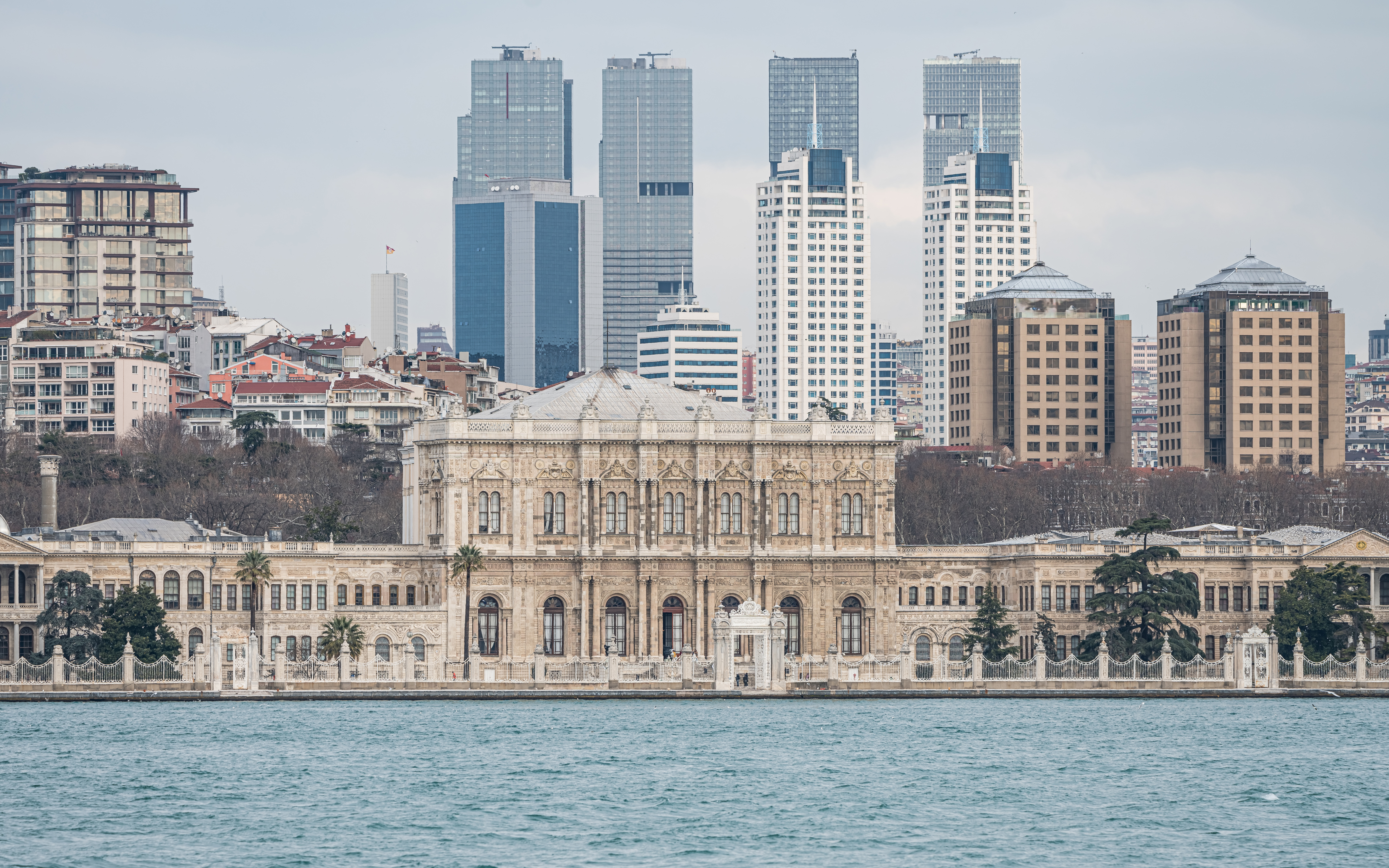
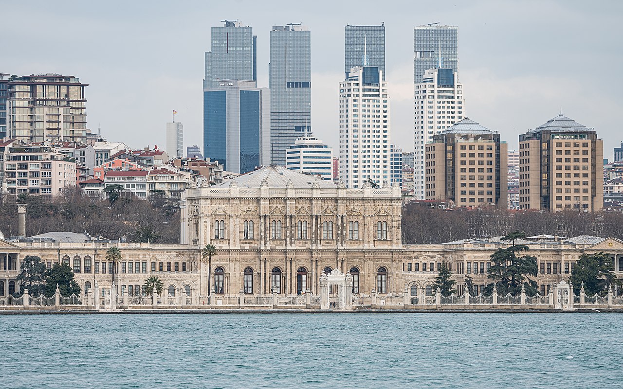
English: Remote view of Dolmabahçe Palace in Istanbul, Turkey
Русский: Вид на дворец Долмабахче в Стамбуле, Турция |
| Date | |
| Source | Own work |
| Author | A.Savin |
| Permission (Reusing this file) |
.svg) Just attribute the author: «A.Savin, Wikipedia»; if you have questions — Telegram, or e-mail to wikiphotospace@gmail.com..svg) Просто укажите в качестве автора: «А.Савин, Википедия»; если есть вопрос — телеграм, или эл.почта на wikiphotospace@gmail.com. Kennzeichnen Sie einfach als Autor: «A.Savin, Wikipedia»; falls Sie Fragen haben — Telegram, oder E-Mail an wikiphotospace@gmail.com.
Thank you. |
| Camera location | | View this and other nearby images on: OpenStreetMap |
|---|
| Object location | | View this and other nearby images on: OpenStreetMap |
|---|
.jpg)
Licensing
| Copyleft: This work of art is free; you can redistribute it and/or modify it according to terms of the Free Art License. You will find a specimen of this license on the Copyleft Attitude site as well as on other sites. |
File history
Click on a date/time to view the file as it appeared at that time.
| Date/Time | Dimensions | User | Comment | |
|---|---|---|---|---|
| current | 20:17, 27 February 2022 | 7,791 × 4,869 (10.73 MB) | A.Savin | Reverted to version as of 15:07, 28 July 2020 (UTC) --no reason to crop this, skyline is part of the composition |
File usage
The following page uses this file: