File:Karte Kanton St. Gallen 2010.png

Size of this preview: 507 × 599 pixels. Other resolutions: 203 × 240 pixels | 406 × 480 pixels | 508 × 600 pixels | 650 × 768 pixels | 866 × 1,024 pixels | 2,066 × 2,442 pixels.
Original file (2,066 × 2,442 pixels, file size: 1.2 MB, MIME type: image/png)
| This is a file from the Wikimedia Commons. The description on its description page there is shown below.
|
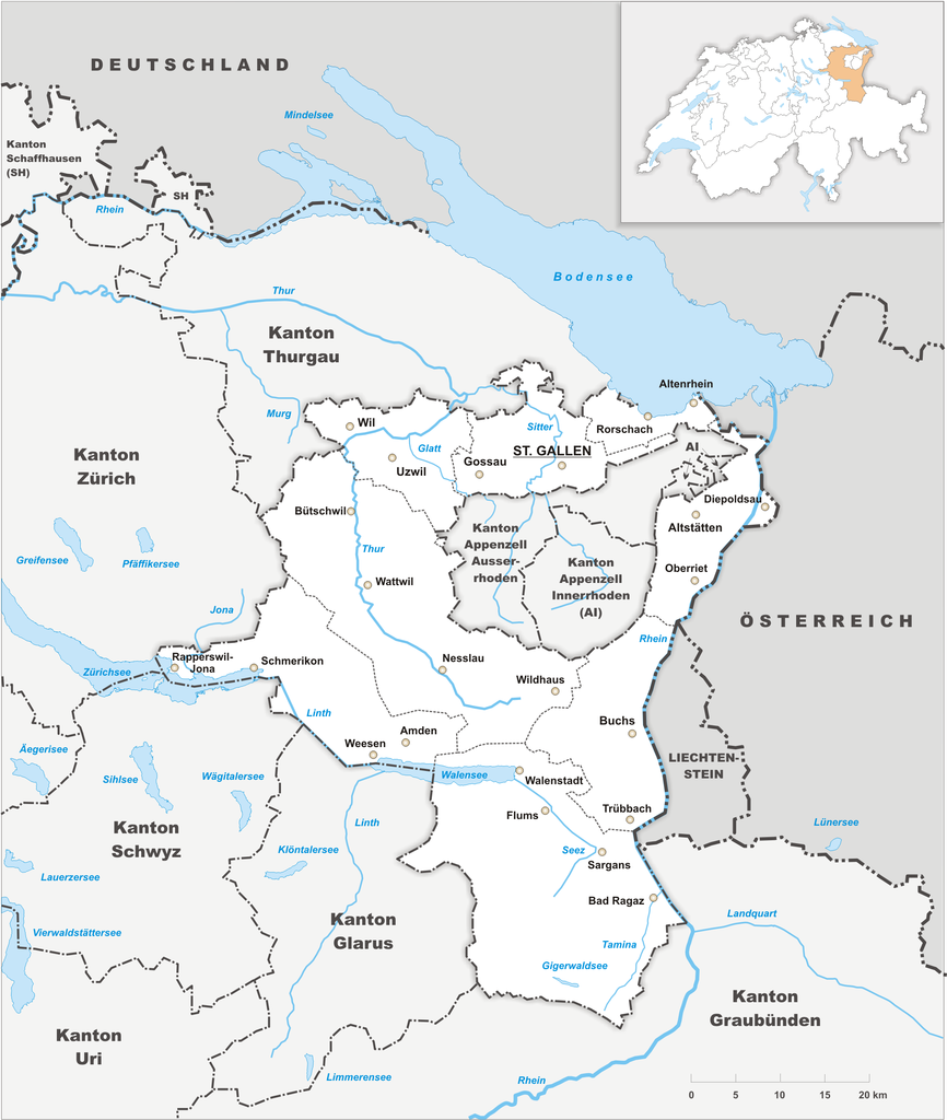
| Description |
Deutsch: Karte des Kanton St. Gallen. |
||||||||
| Date | |||||||||
| Source | Own work | ||||||||
| Author | Tschubby | ||||||||
| Permission (Reusing this file) |
I, the copyright holder of this work, hereby publish it under the following licenses:
This file is licensed under the Creative Commons Attribution-Share Alike 2.5 Generic, 2.0 Generic and 1.0 Generic license.
You may select the license of your choice. |

File history
Click on a date/time to view the file as it appeared at that time.
| Date/Time | Dimensions | User | Comment | |
|---|---|---|---|---|
| current | 15:15, 29 October 2009 | 2,066 × 2,442 (1.2 MB) | Tschubby | {{Information |Description= {{de|Karte des Kanton St. Gallen.}} |Source={{own}} |Date= 29.10.2009 |Author= Tschubby |Permission= {{self|GFDL|Cc-by-sa-3.0-migrated|Cc-by-sa-2.5,2.0,1.0}} }} [[Category:Maps o |
File usage
The following page uses this file: