File:LK6509-Garching-Süd-Luftbild.jpg

Size of this preview: 800 × 545 pixels. Other resolutions: 320 × 218 pixels | 640 × 436 pixels | 1,024 × 698 pixels | 1,280 × 872 pixels | 2,861 × 1,950 pixels.
Original file (2,861 × 1,950 pixels, file size: 4.68 MB, MIME type: image/jpeg)
| This is a file from the Wikimedia Commons. The description on its description page there is shown below.
|
Summary
| Description |
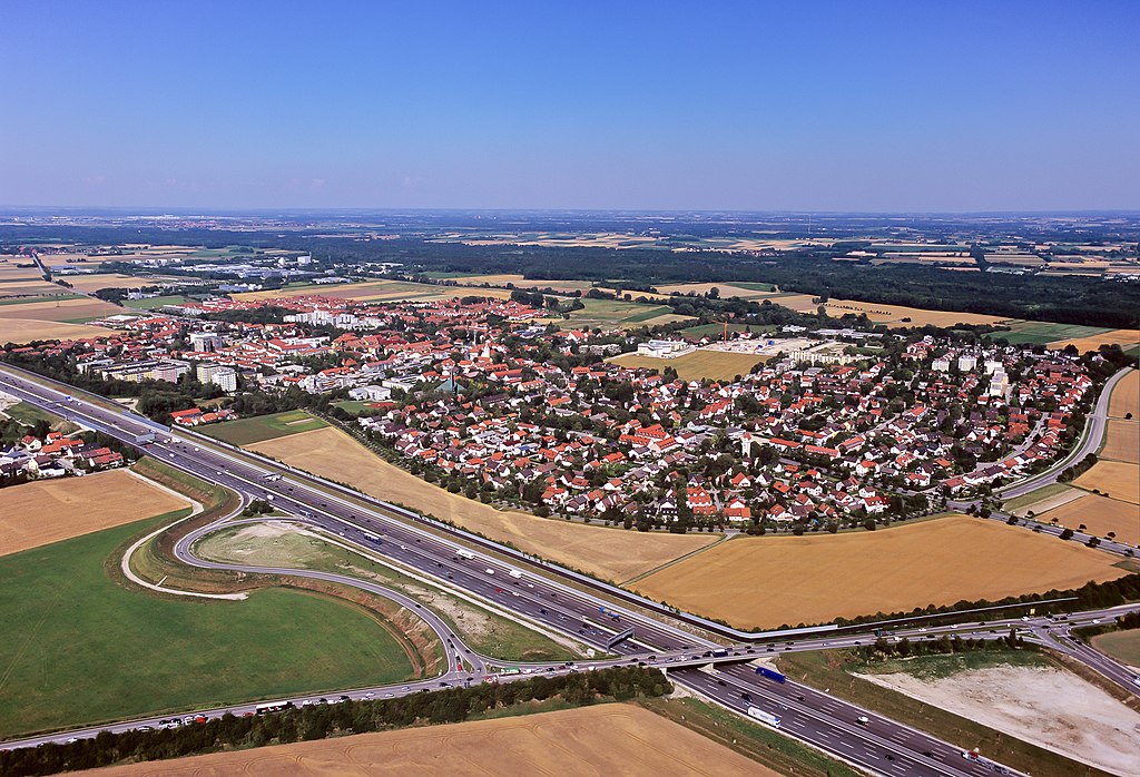
English: Aerial photograph of Garching town. Garching is situated 15 kilometres north of Munich. The motorway A9 from Munich to Berlin passes the western side of Garching. Many research facilities of the Munich universities and private companies reside in Garching.
Deutsch: Luftbildaufnahme von Garching. Garching liegt 15 km Norden Münchens. Die Bundesautobahn A9 von München nach Berlin führt an Garching im Westen vorbei. Viele Forschungseinrichtungen der Münchner Universitäten und Unternehmen haben hier ihren Sitz. |
||||
| Date | |||||
| Source | Own work | ||||
| Author | M-Luftbild | ||||
| Permission (Reusing this file) |
If you want to use this file commercially, you have to do this under the terms of the GFDL.
|

| Camera location | | View this and other nearby images on: OpenStreetMap |
|---|
Licensing
I, the copyright holder of this work, hereby publish it under the following license:
This file is licensed under the Creative Commons Attribution-Share Alike 3.0 Unported license.
- You are free:
- to share – to copy, distribute and transmit the work
- to remix – to adapt the work
- Under the following conditions:
- attribution – You must give appropriate credit, provide a link to the license, and indicate if changes were made. You may do so in any reasonable manner, but not in any way that suggests the licensor endorses you or your use.
- share alike – If you remix, transform, or build upon the material, you must distribute your contributions under the same or compatible license as the original.
| Annotations | This image is annotated: View the annotations at Commons |
This image has been assessed using the Quality image guidelines and is considered a Quality image.
|
File history
Click on a date/time to view the file as it appeared at that time.
| Date/Time | Dimensions | User | Comment | |
|---|---|---|---|---|
| current | 13:35, 6 June 2011 | 2,861 × 1,950 (4.68 MB) | Lmbuga | Vignetting, noise, unsharp... |
File usage
The following page uses this file: