File:Laccadives Hume 1875.jpg
Size of this preview: 702 × 599 pixels. Other resolutions: 281 × 240 pixels | 562 × 480 pixels | 703 × 600 pixels | 900 × 768 pixels | 1,200 × 1,024 pixels | 3,010 × 2,569 pixels.
Original file (3,010 × 2,569 pixels, file size: 2.28 MB, MIME type: image/jpeg)
| This is a file from the Wikimedia Commons. The description on its description page there is shown below.
|
| Description |
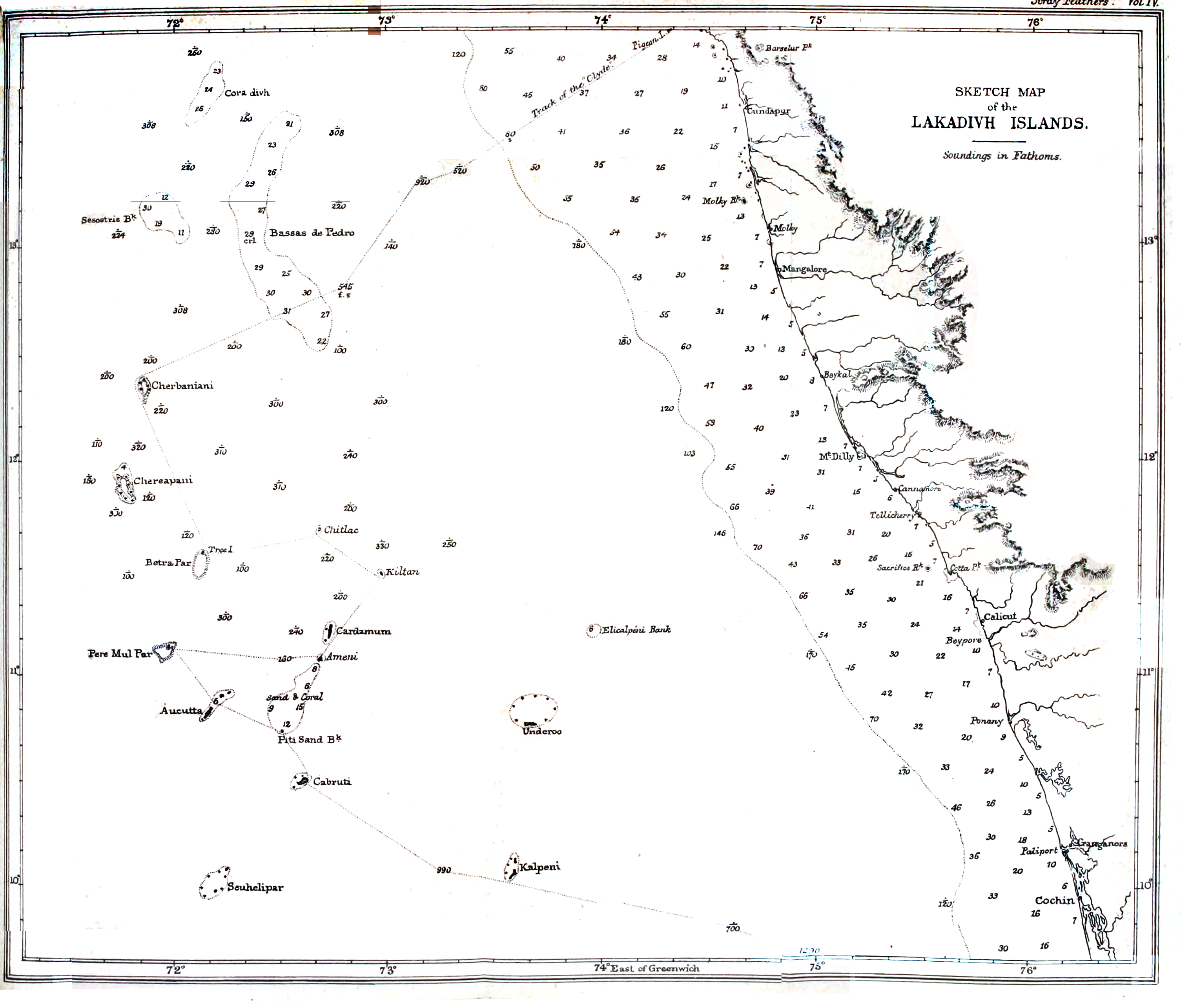
Depth map around the Lakshadweep Islands made by A O Hume |
|||||||||
| Date | ||||||||||
| Source | Stray Feathers. Volume 4 | |||||||||
| Creator |
Allan Octavian Hume |
|||||||||
| Permission (Reusing this file) |
|
|||||||||
| Geotemporal data | ||||||||||
| Bounding box |
|
|||||||||
| Georeferencing | ||||||||||
File history
Click on a date/time to view the file as it appeared at that time.
| Date/Time | Dimensions | User | Comment | |
|---|---|---|---|---|
| current | 05:24, 13 December 2016 | 3,010 × 2,569 (2.28 MB) | Shyamal | {{Information |Description=Depth map around the Lakshadweep Islands made by A O Hume |Source=[https://archive.org/stream/strayfeathersjou41876hume#page/n450/mode/1up Stray Feathers. Volume 4] |Date=1876 |Author=Allan Octavian Hume |Permission={{pd-old-... |
File usage
The following page uses this file: