File:Lakenheath Signal Box - geograph.org.uk - 1917817.jpg
No higher resolution available.
Lakenheath_Signal_Box_-_geograph.org.uk_-_1917817.jpg (800 × 531 pixels, file size: 145 KB, MIME type: image/jpeg)
| This is a file from the Wikimedia Commons. The description on its description page there is shown below.
|
Summary
| Description |
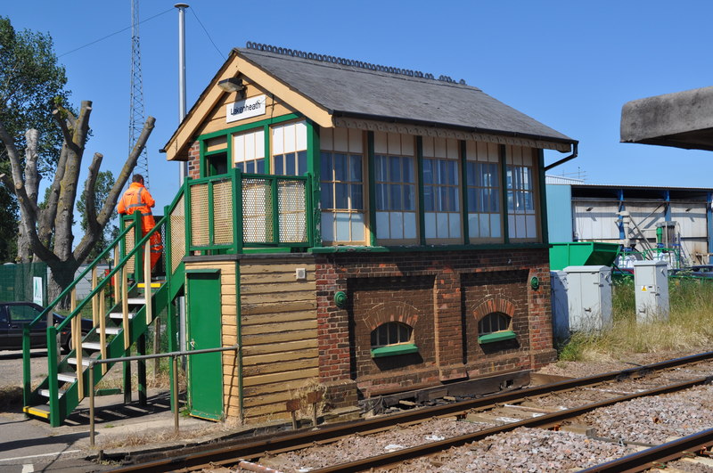
English: Lakenheath Signal Box, near to Hockwold Cum Wilton, Norfolk, Great Britain.
A view of the signalbox and crossing gates at Lakenheath Railway Station. This is part of the ex Eastern Counties Railway, which had extended its route from Shoreditch to Newport, Essex northwards via Cambridge and Ely to Brandon. Connecting with the Norwich to Brandon Railway in July 1845. Hand operated crossings are a rare find these days, there are still a few in East Anglia but these ones will be wiped out by a new experimental signalling scheme on this line |
| Date | |
| Source | From geograph.org.uk; transferred by User:Rubberstamp using geograph_org2commons. |
| Author | Ashley Dace |
| Permission (Reusing this file) |
Creative Commons Attribution Share-alike license 2.0 |
| Attribution (required by the license) | Ashley Dace / Lakenheath Signal Box / |
| Camera location | | View this and other nearby images on: OpenStreetMap |
|---|
| Object location | | View this and other nearby images on: OpenStreetMap |
|---|
_region:GB-GBN_heading:45.00&language=en)
Licensing

|
This image was taken from the Geograph project collection. See this photograph's page on the Geograph website for the photographer's contact details. The copyright on this image is owned by Ashley Dace and is licensed for reuse under the Creative Commons Attribution-ShareAlike 2.0 license.
|
This file is licensed under the Creative Commons Attribution-Share Alike 2.0 Generic license.
Attribution: Ashley Dace
- You are free:
- to share – to copy, distribute and transmit the work
- to remix – to adapt the work
- Under the following conditions:
- attribution – You must give appropriate credit, provide a link to the license, and indicate if changes were made. You may do so in any reasonable manner, but not in any way that suggests the licensor endorses you or your use.
- share alike – If you remix, transform, or build upon the material, you must distribute your contributions under the same or compatible license as the original.
File history
Click on a date/time to view the file as it appeared at that time.
| Date/Time | Dimensions | User | Comment | |
|---|---|---|---|---|
| current | 07:23, 27 July 2010 | 800 × 531 (145 KB) | File Upload Bot (Magnus Manske) | == {{int:filedesc}} == {{Information |Description={{en|1=Lakenheath Signal Box, near to Hockwold Cum Wilton, Norfolk, Great Britain. A view of the signalbox and crossing gates at Lakenheath Railway Station. This is part of the ex Eastern Counties Railway, |
File usage
The following page uses this file: