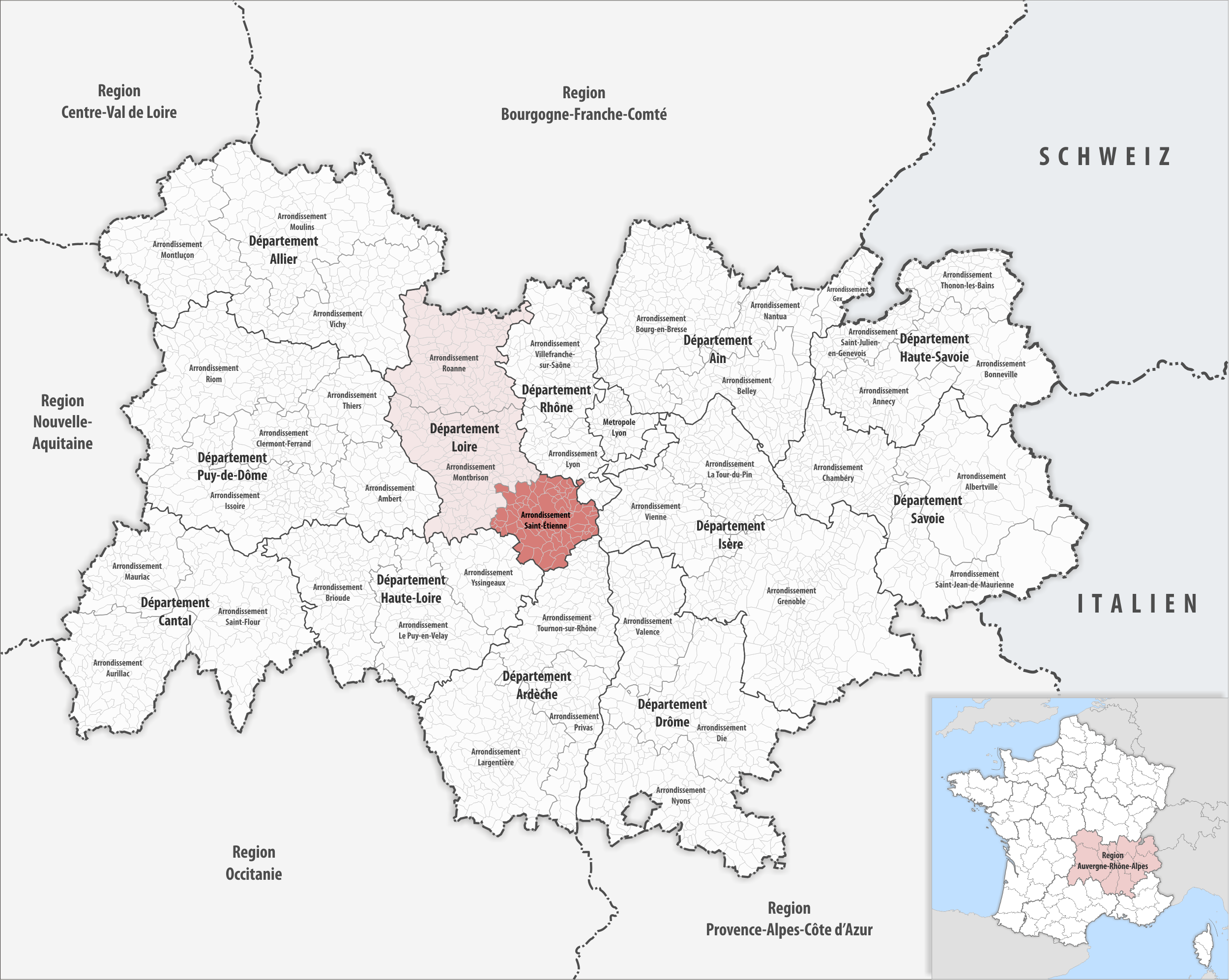
File:Locator map of Arrondissement Saint-Étienne 2019.png
Size of this preview: 751 × 599 pixels. Other resolutions: 301 × 240 pixels | 602 × 480 pixels | 752 × 600 pixels | 963 × 768 pixels | 1,280 × 1,021 pixels | 2,500 × 1,995 pixels.
Original file (2,500 × 1,995 pixels, file size: 1.51 MB, MIME type: image/png)
| This is a file from the Wikimedia Commons. The description on its description page there is shown below.
|
Summary
| Description |
Deutsch: Lage des Arrondissements Saint-Étienne |
||||||||
| Date | |||||||||
| Source | Own work | ||||||||
| Author | Tschubby | ||||||||
| Permission (Reusing this file) |
I, the copyright holder of this work, hereby publish it under the following licenses:
This file is licensed under the Creative Commons Attribution-Share Alike 2.5 Generic, 2.0 Generic and 1.0 Generic license.
You may select the license of your choice. |

File history
Click on a date/time to view the file as it appeared at that time.
| Date/Time | Dimensions | User | Comment | |
|---|---|---|---|---|
| current | 07:12, 29 July 2021 | 2,500 × 1,995 (1.51 MB) | Tschubby | {{Information |Description= |Source= |Date= |Author= |Permission= |other_versions= }} |
File usage
The following page uses this file: